Area Overview for TW20 8SR
Photos of TW20 8SR
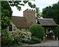

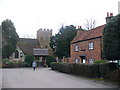
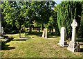
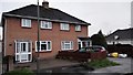
52 photos from this area
Area Information
Key information about the TW20 8SR including its size, population, and administrative classification.
- Area Type
- Postcode
- Area Size
- 3.5 hectares
- Population
- 1499
- Population Density
- 327 people/km²
House Prices in TW20 8SR
13
Properties
£450,863
Average Sold Price
£320,000
Lowest Price
£600,000
Highest Price
Showing 13 properties
| Address | Type | Beds | Baths | Last Sale Price | Last Sale Date | |
|---|---|---|---|---|---|---|
| Grey Mists, Coldharbour Lane, Thorpe, TW20 8SR | Bungalow | 3 | 1 | £560,000 | Oct 2019 | |
| The White House, Coldharbour Lane, Thorpe, TW20 8SR | Detached | - | - | £600,000 | Apr 2006 | |
| 2, Manor Farm Cottages, Coldharbour Lane, Thorpe, TW20 8SR | Semi-detached | - | - | £323,450 | Jul 2003 | |
| Nell Gwynne Cottage, Coldharbour Lane, Thorpe, TW20 8SR | Bungalow | - | - | £320,000 | Jun 2001 | |
| Flat 2 At 2ND Floor, Thorpe House, Coldharbour Lane, Thorpe, TW20 8SR | Flat | - | - | - | - | |
| 1, Manor Farm Cottages, Coldharbour Lane, Thorpe, TW20 8SR | house | - | - | - | - | |
| Accommodation, Thorpe House, Coldharbour Lane, Thorpe, TW20 8SR | Flat | - | - | - | - | |
| Flat 1 At 2ND Floor, Thorpe House, Coldharbour Lane, Thorpe, TW20 8SR | Flat | - | - | - | - | |
| Renalds Herne, Coldharbour Lane, Thorpe, TW20 8SR | Detached | - | - | - | - | |
| Toad Hall, Coldharbour Lane, Thorpe, TW20 8SR | Detached | - | - | - | - |
Page 1 of 2
Energy Efficiency in TW20 8SR
Amenities
Schools
| Rank | School | Type | Entry gender | Ages |
|---|
Explore more schools in this area
Go to Schools tabDemographics
Household Size
Family (3-5 people)
most common
Accommodation Type
Houses
most common
Tenure
84
majority
Ethnic Group
White
most common
Religion
N/A
most common
Household Composition
N/A
most common
Age
47
median
Adults (30-64 years)
most common
Household Deprivation
N/A
with no deprivation
NS-SEC
39
in Lower managerial occupations
Explore more demographic insights in this area
Go to Demographics tabPlanning
Planning Constraints
- Flood RiskPremium
- Ramsar Wetland SitesPremium
- Area of Outstanding Natural BeautyPremium
- Protected Nature ReservePremium
- Protected WoodlandPremium