Area Overview for TW20 8QT
Photos of TW20 8QT
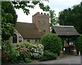
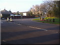
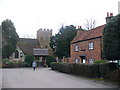
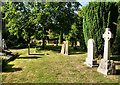
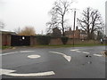
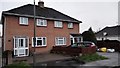
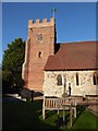
52 photos from this area
Area Information
Key information about the TW20 8QT including its size, population, and administrative classification.
- Area Type
- Postcode
- Area Size
- 9.3 hectares
- Population
- 1499
- Population Density
- 327 people/km²
House Prices in TW20 8QT
27
Properties
£556,250
Average Sold Price
£275,000
Lowest Price
£1,100,000
Highest Price
Showing 27 properties
| Address | Type | Beds | Baths | Last Sale Price | Last Sale Date | |
|---|---|---|---|---|---|---|
| Little Orchard, Green Road, Thorpe, TW20 8QT | Detached | 4 | 3 | £1,100,000 | Jul 2024 | |
| Fieldcrest, Green Road, Thorpe, TW20 8QT | Detached | 4 | 2 | £725,000 | Jun 2024 | |
| Cherrycroft, Green Road, Thorpe, TW20 8QT | Semi-detached | 3 | - | £580,000 | May 2021 | |
| Glencairn, Green Road, Thorpe, TW20 8QT | Bungalow | 3 | 2 | £920,000 | Jan 2019 | |
| Ashling, Green Road, Thorpe, TW20 8QT | Semi-detached | 4 | - | £530,000 | Dec 2017 | |
| Portobello, Green Road, Thorpe, TW20 8QT | Detached | 5 | - | £625,000 | Jan 2015 | |
| 4 Green Road, Thorpe, TW20 8QT | Semi-detached | 5 | 3 | £417,500 | Mar 2014 | |
| Hill View, Green Road, Thorpe, TW20 8QT | Land | - | - | £410,000 | Nov 2013 | |
| Millgreen, Green Road, Thorpe, TW20 8QT | house | - | - | £490,000 | Oct 2013 | |
| 3 Green Road, Thorpe, TW20 8QT | Semi-detached | 4 | 2 | £380,000 | Jun 2013 |
Page 1 of 3
Energy Efficiency in TW20 8QT
Amenities
Schools
| Rank | School | Type | Entry gender | Ages |
|---|
Explore more schools in this area
Go to Schools tabDemographics
Household Size
Family (3-5 people)
most common
Accommodation Type
Houses
most common
Tenure
84
majority
Ethnic Group
White
most common
Religion
N/A
most common
Household Composition
N/A
most common
Age
47
median
Adults (30-64 years)
most common
Household Deprivation
N/A
with no deprivation
NS-SEC
39
in Lower managerial occupations
Explore more demographic insights in this area
Go to Demographics tabPlanning
Planning Constraints
- Flood RiskPremium
- Ramsar Wetland SitesPremium
- Area of Outstanding Natural BeautyPremium
- Protected Nature ReservePremium
- Protected WoodlandPremium