Area Overview for TW20 8BL
Photos of TW20 8BL

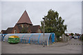
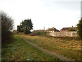
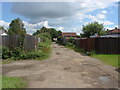
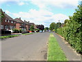
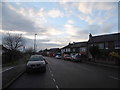
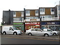
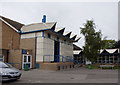
20 photos from this area
Area Information
Key information about the TW20 8BL including its size, population, and administrative classification.
- Area Type
- Postcode
- Area Size
- 5164 m²
- Population
- 1607
- Population Density
- 3581 people/km²
House Prices in TW20 8BL
18
Properties
£416,667
Average Sold Price
£275,000
Lowest Price
£540,000
Highest Price
Showing 18 properties
| Address | Type | Beds | Baths | Last Sale Price | Last Sale Date | |
|---|---|---|---|---|---|---|
| 134A Thorpe Lea Road, Egham, TW20 8BL | Flat | 1 | 1 | £485,000 | Mar 2025 | |
| 114 Thorpe Lea Road, Egham, TW20 8BL | Maisonette | 2 | 1 | £275,000 | Jun 2024 | |
| 120 Thorpe Lea Road, Egham, TW20 8BL | Retail | 3 | 1 | £540,000 | Sep 2022 | |
| 118 Thorpe Lea Road, Egham, TW20 8BL | Semi-detached | 3 | 1 | £420,000 | Apr 2018 | |
| 122 Thorpe Lea Road, Egham, TW20 8BL | house | - | - | £400,000 | Dec 2017 | |
| 124 Thorpe Lea Road, Egham, TW20 8BL | Detached | 3 | 2 | £380,000 | Oct 2015 | |
| 114A Thorpe Lea Road, Egham, TW20 8BL | Flat | 2 | 1 | - | - | |
| 110A Thorpe Lea Road, Egham, TW20 8BL | Maisonette | 3 | 1 | - | - | |
| 108B Thorpe Lea Road, Egham, TW20 8BL | Office | - | - | - | - | |
| 108A Thorpe Lea Road, Egham, TW20 8BL | Flat | - | - | - | - |
Page 1 of 2
Energy Efficiency in TW20 8BL
Amenities
Schools
| Rank | School | Type | Entry gender | Ages |
|---|
Explore more schools in this area
Go to Schools tabDemographics
Household Size
Family (3-5 people)
most common
Accommodation Type
Houses
most common
Tenure
59
majority
Ethnic Group
White
most common
Religion
N/A
most common
Household Composition
N/A
most common
Age
47
median
Adults (30-64 years)
most common
Household Deprivation
N/A
with no deprivation
NS-SEC
33
in Lower managerial occupations
Explore more demographic insights in this area
Go to Demographics tabPlanning
Planning Constraints
- Flood RiskPremium
- Ramsar Wetland SitesPremium
- Area of Outstanding Natural BeautyPremium
- Protected Nature ReservePremium
- Protected WoodlandPremium