Area Overview for TW20 0SU
Photos of TW20 0SU
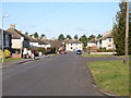
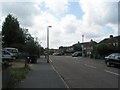
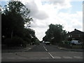
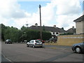
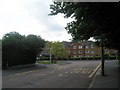
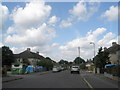
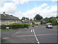
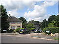
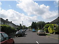
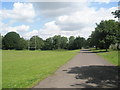

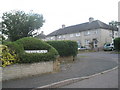
93 photos from this area
Area Information
Key information about the TW20 0SU including its size, population, and administrative classification.
- Area Type
- Postcode
- Area Size
- 6603 m²
- Population
- 1457
- Population Density
- 4353 people/km²
House Prices in TW20 0SU
21
Properties
£286,682
Average Sold Price
£95,000
Lowest Price
£499,999
Highest Price
Showing 21 properties
| Address | Type | Beds | Baths | Last Sale Price | Last Sale Date | |
|---|---|---|---|---|---|---|
| 26 Ashwood Road, Englefield Green, TW20 0SU | Semi-detached | 5 | 1 | £363,000 | Jul 2018 | |
| 4 Ashwood Road, Englefield Green, TW20 0SU | house | - | - | £499,999 | Aug 2017 | |
| 6 Ashwood Road, Englefield Green, TW20 0SU | Semi-detached | 4 | 1 | £365,000 | May 2017 | |
| 20 Ashwood Road, Englefield Green, TW20 0SU | Semi-detached | 4 | 1 | £370,000 | Oct 2016 | |
| 24 Ashwood Road, Englefield Green, TW20 0SU | house | - | - | £290,000 | Oct 2014 | |
| 18 Ashwood Road, Englefield Green, TW20 0SU | Semi-detached | 5 | 3 | £277,500 | Jul 2013 | |
| 16 Ashwood Road, Englefield Green, TW20 0SU | Semi-detached | 5 | 2 | £285,000 | Jul 2010 | |
| 12 Ashwood Road, Englefield Green, TW20 0SU | house | - | - | £230,000 | Feb 2006 | |
| 34 Ashwood Road, Englefield Green, TW20 0SU | Semi-detached | 4 | 1 | £228,000 | Sep 2004 | |
| 36 Ashwood Road, Englefield Green, TW20 0SU | Semi-detached | 3 | - | £150,000 | Apr 2002 |
Page 1 of 3
Energy Efficiency in TW20 0SU
Amenities
Schools
| Rank | School | Type | Entry gender | Ages |
|---|
Explore more schools in this area
Go to Schools tabDemographics
Household Size
Family (3-5 people)
most common
Accommodation Type
Houses
most common
Tenure
20
majority
Ethnic Group
White
most common
Religion
N/A
most common
Household Composition
N/A
most common
Age
22
median
Young Adults (15-29 years)
most common
Household Deprivation
N/A
with no deprivation
NS-SEC
15
in Lower managerial occupations
Explore more demographic insights in this area
Go to Demographics tabPlanning
Planning Constraints
- Flood RiskPremium
- Ramsar Wetland SitesPremium
- Area of Outstanding Natural BeautyPremium
- Protected Nature ReservePremium
- Protected WoodlandPremium