Area Overview for TW19 7RH
Photos of TW19 7RH
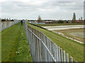
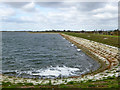
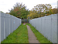
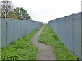

55 photos from this area
Area Information
Key information about the TW19 7RH including its size, population, and administrative classification.
- Area Type
- Postcode
- Area Size
- 1.1 hectares
- Population
- 1978
- Population Density
- 6692 people/km²
House Prices in TW19 7RH
31
Properties
£336,398
Average Sold Price
£116,000
Lowest Price
£473,000
Highest Price
Showing 31 properties
| Address | Type | Beds | Baths | Last Sale Price | Last Sale Date | |
|---|---|---|---|---|---|---|
| 18 Clyde Road, Stanwell, TW19 7RH | Terraced | 4 | 2 | £445,000 | Sep 2023 | |
| 40 Clyde Road, Stanwell, TW19 7RH | Retail | 3 | 2 | £442,000 | May 2022 | |
| 26 Clyde Road, Stanwell, TW19 7RH | house | - | - | £473,000 | Dec 2021 | |
| 16 Clyde Road, Stanwell, TW19 7RH | house | - | - | £448,000 | Oct 2021 | |
| 56 Clyde Road, Stanwell, TW19 7RH | house | - | - | £465,000 | Mar 2021 | |
| 28 Clyde Road, Stanwell, TW19 7RH | Terraced | 2 | - | £365,000 | Feb 2021 | |
| 20 Clyde Road, Stanwell, TW19 7RH | house | - | - | £390,000 | Nov 2020 | |
| 36 Clyde Road, Stanwell, TW19 7RH | Terraced | 4 | 1 | £370,000 | Sep 2020 | |
| 2 Clyde Road, Stanwell, TW19 7RH | house | - | - | £390,000 | Jul 2020 | |
| 44 Clyde Road, Stanwell, TW19 7RH | Terraced | 3 | 1 | £320,000 | Jan 2019 |
Page 1 of 4
Energy Efficiency in TW19 7RH
Amenities
Schools
| Rank | School | Type | Entry gender | Ages |
|---|
Explore more schools in this area
Go to Schools tabDemographics
Household Size
Family (3-5 people)
most common
Accommodation Type
Houses
most common
Tenure
51
majority
Ethnic Group
White
most common
Religion
N/A
most common
Household Composition
N/A
most common
Age
47
median
Adults (30-64 years)
most common
Household Deprivation
N/A
with no deprivation
NS-SEC
27
in Lower managerial occupations
Explore more demographic insights in this area
Go to Demographics tabPlanning
Planning Constraints
- Flood RiskPremium
- Ramsar Wetland SitesPremium
- Area of Outstanding Natural BeautyPremium
- Protected Nature ReservePremium
- Protected WoodlandPremium