Area Overview for TW19 7BG
Photos of TW19 7BG
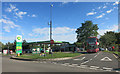
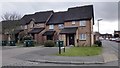
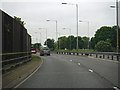
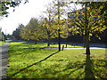
57 photos from this area
Area Information
Key information about the TW19 7BG including its size, population, and administrative classification.
- Area Type
- Postcode
- Area Size
- 1.3 hectares
- Population
- 1863
- Population Density
- 3330 people/km²
House Prices in TW19 7BG
48
Properties
£202,174
Average Sold Price
£169,950
Lowest Price
£265,000
Highest Price
Showing 48 properties
| Address | Type | Beds | Baths | Last Sale Price | Last Sale Date | |
|---|---|---|---|---|---|---|
| 25 Dudley Place, Stanwell, TW19 7BG | Flat | - | - | £197,500 | Sep 2022 | |
| 6 Dudley Place, Stanwell, TW19 7BG | Flat | - | - | £187,000 | Mar 2020 | |
| 8 Dudley Place, Stanwell, TW19 7BG | Flat | - | - | £207,500 | Oct 2019 | |
| 15 Dudley Place, Stanwell, TW19 7BG | Flat | - | - | £200,000 | Oct 2019 | |
| 14 Dudley Place, Stanwell, TW19 7BG | Flat | - | - | £265,000 | Jun 2017 | |
| 4 Dudley Place, Stanwell, TW19 7BG | Flat | - | - | £235,000 | May 2016 | |
| 1 Dudley Place, Stanwell, TW19 7BG | Flat | 2 | 2 | £250,000 | Mar 2016 | |
| 28 Dudley Place, Stanwell, TW19 7BG | Flat | - | - | £188,000 | Dec 2015 | |
| 18 Dudley Place, Stanwell, TW19 7BG | Flat | 1 | 1 | £170,000 | Dec 2014 | |
| 3 Dudley Place, Stanwell, TW19 7BG | Flat | - | - | £190,000 | Oct 2014 |
Page 1 of 5
Energy Efficiency in TW19 7BG
Amenities
Schools
| Rank | School | Type | Entry gender | Ages |
|---|
Explore more schools in this area
Go to Schools tabDemographics
Household Size
Family (3-5 people)
most common
Accommodation Type
Houses
most common
Tenure
55
majority
Ethnic Group
White
most common
Religion
N/A
most common
Household Composition
N/A
most common
Age
47
median
Adults (30-64 years)
most common
Household Deprivation
N/A
with no deprivation
NS-SEC
25
in Lower managerial occupations
Explore more demographic insights in this area
Go to Demographics tabPlanning
Planning Constraints
- Flood RiskPremium
- Ramsar Wetland SitesPremium
- Area of Outstanding Natural BeautyPremium
- Protected Nature ReservePremium
- Protected WoodlandPremium