Area Overview for TW19 6EB
Photos of TW19 6EB
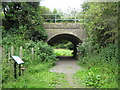
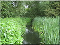


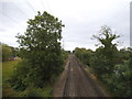
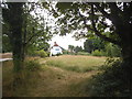


98 photos from this area
Area Information
Key information about the TW19 6EB including its size, population, and administrative classification.
- Area Type
- Postcode
- Area Size
- 3.7 hectares
- Population
- 1652
- Population Density
- 540 people/km²
House Prices in TW19 6EB
14
Properties
£344,990
Average Sold Price
£184,950
Lowest Price
£525,000
Highest Price
Showing 14 properties
| Address | Type | Beds | Baths | Last Sale Price | Last Sale Date | |
|---|---|---|---|---|---|---|
| Glenmor, Moor Lane, Staines Upon Thames, TW19 6EB | Semi-detached | 3 | 1 | £500,000 | May 2022 | |
| Swan House, Moor Lane, Staines Upon Thames, TW19 6EB | Detached | 5 | 5 | £525,000 | Apr 2012 | |
| Moor Croft, Moor Lane, Staines Upon Thames, TW19 6EB | house | 3 | 1 | £250,000 | Jul 2011 | |
| Veradene, Moor Lane, Staines Upon Thames, TW19 6EB | Semi-detached | - | - | £265,000 | Aug 2007 | |
| Moorside, Moor Lane, Staines Upon Thames, TW19 6EB | Semi-detached | - | - | £184,950 | Jun 2000 | |
| 1, Moor Farm Dairy, Watermans Cottages, Moor Lane, Staines Upon Thames, TW19 6EB | Terraced | 3 | 1 | - | - | |
| Jomar, Moor Lane, Staines Upon Thames, TW19 6EB | Land | - | - | - | - | |
| Moor Cottage, Moor Lane, Staines Upon Thames, TW19 6EB | Land | 3 | - | - | - | |
| Flat, The Swan Inn, Moor Lane, Staines Upon Thames, TW19 6EB | Flat | - | - | - | - | |
| Carousell, Moor Lane, Staines Upon Thames, TW19 6EB | Terraced | 3 | - | - | - |
Page 1 of 2
Energy Efficiency in TW19 6EB
Amenities
Schools
| Rank | School | Type | Entry gender | Ages |
|---|
Explore more schools in this area
Go to Schools tabDemographics
Household Size
Family (3-5 people)
most common
Accommodation Type
Houses
most common
Tenure
66
majority
Ethnic Group
White
most common
Religion
N/A
most common
Household Composition
N/A
most common
Age
47
median
Adults (30-64 years)
most common
Household Deprivation
N/A
with no deprivation
NS-SEC
46
in Lower managerial occupations
Explore more demographic insights in this area
Go to Demographics tabPlanning
Planning Constraints
- Flood RiskPremium
- Ramsar Wetland SitesPremium
- Area of Outstanding Natural BeautyPremium
- Protected Nature ReservePremium
- Protected WoodlandPremium