Area Overview for TW18 3DQ
Photos of TW18 3DQ

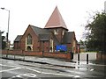

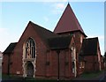
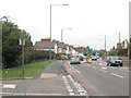
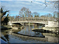


78 photos from this area
Area Information
Key information about the TW18 3DQ including its size, population, and administrative classification.
- Area Type
- Postcode
- Area Size
- 1.4 hectares
- Population
- 1607
- Population Density
- 3581 people/km²
House Prices in TW18 3DQ
35
Properties
£301,116
Average Sold Price
£98,000
Lowest Price
£500,000
Highest Price
Showing 35 properties
| Address | Type | Beds | Baths | Last Sale Price | Last Sale Date | |
|---|---|---|---|---|---|---|
| 152 Wendover Road, Staines Upon Thames, TW18 3DQ | Semi-detached | 3 | 1 | £483,500 | Mar 2025 | |
| 149 Wendover Road, Staines Upon Thames, TW18 3DQ | Semi-detached | 2 | 1 | £315,000 | Mar 2024 | |
| 120 Wendover Road, Staines Upon Thames, TW18 3DQ | Semi-detached | 4 | 2 | £500,000 | Sep 2022 | |
| 121 Wendover Road, Staines Upon Thames, TW18 3DQ | Semi-detached | 2 | 1 | £407,500 | Jul 2022 | |
| 147 Wendover Road, Staines Upon Thames, TW18 3DQ | Semi-detached | 3 | 1 | £412,500 | Feb 2022 | |
| 154 Wendover Road, Staines Upon Thames, TW18 3DQ | house | 3 | - | £480,000 | May 2021 | |
| 119 Wendover Road, Staines Upon Thames, TW18 3DQ | Semi-detached | 2 | 2 | £490,000 | Nov 2020 | |
| 136 Wendover Road, Staines Upon Thames, TW18 3DQ | Terraced | 2 | 1 | £368,400 | Mar 2018 | |
| 156 Wendover Road, Staines Upon Thames, TW18 3DQ | house | - | - | £477,500 | Dec 2016 | |
| 130 Wendover Road, Staines Upon Thames, TW18 3DQ | Semi-detached | 4 | - | £380,000 | Aug 2016 |
Page 1 of 4
Energy Efficiency in TW18 3DQ
Amenities
Schools
| Rank | School | Type | Entry gender | Ages |
|---|
Explore more schools in this area
Go to Schools tabDemographics
Household Size
Family (3-5 people)
most common
Accommodation Type
Houses
most common
Tenure
59
majority
Ethnic Group
White
most common
Religion
N/A
most common
Household Composition
N/A
most common
Age
47
median
Adults (30-64 years)
most common
Household Deprivation
N/A
with no deprivation
NS-SEC
33
in Lower managerial occupations
Explore more demographic insights in this area
Go to Demographics tabPlanning
Planning Constraints
- Flood RiskPremium
- Ramsar Wetland SitesPremium
- Area of Outstanding Natural BeautyPremium
- Protected Nature ReservePremium
- Protected WoodlandPremium