Area Overview for TW18 1PA
Photos of TW18 1PA
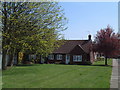


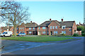


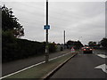
27 photos from this area
Area Information
Key information about the TW18 1PA including its size, population, and administrative classification.
- Area Type
- Postcode
- Area Size
- 1.6 hectares
- Population
- 1849
- Population Density
- 5191 people/km²
House Prices in TW18 1PA
24
Properties
£352,607
Average Sold Price
£115,000
Lowest Price
£727,500
Highest Price
Showing 24 properties
| Address | Type | Beds | Baths | Last Sale Price | Last Sale Date | |
|---|---|---|---|---|---|---|
| 207 Kingston Road, Staines Upon Thames, TW18 1PA | Detached | 4 | 1 | £727,500 | Mar 2025 | |
| 245 Kingston Road, Staines Upon Thames, TW18 1PA | Bungalow | - | - | £545,000 | Jul 2021 | |
| 243 Kingston Road, Staines Upon Thames, TW18 1PA | Bungalow | - | - | £440,000 | Oct 2020 | |
| 223 Kingston Road, Staines Upon Thames, TW18 1PA | house | 3 | 1 | £525,000 | Oct 2020 | |
| 239 Kingston Road, Staines Upon Thames, TW18 1PA | Detached | 4 | 1 | £475,000 | May 2018 | |
| 215 Kingston Road, Staines Upon Thames, TW18 1PA | house | - | - | £450,000 | Dec 2017 | |
| 203 Kingston Road, Staines Upon Thames, TW18 1PA | house | - | - | £330,000 | Dec 2010 | |
| 213 Kingston Road, Staines Upon Thames, TW18 1PA | house | - | - | £295,000 | Jul 2010 | |
| 209 Kingston Road, Staines Upon Thames, TW18 1PA | house | - | - | £282,000 | Sep 2006 | |
| 201 Kingston Road, Staines Upon Thames, TW18 1PA | Semi-detached | 3 | - | £274,000 | Sep 2006 |
Page 1 of 3
Energy Efficiency in TW18 1PA
Amenities
Schools
| Rank | School | Type | Entry gender | Ages |
|---|
Explore more schools in this area
Go to Schools tabDemographics
Household Size
Family (3-5 people)
most common
Accommodation Type
Houses
most common
Tenure
59
majority
Ethnic Group
White
most common
Religion
N/A
most common
Household Composition
N/A
most common
Age
47
median
Adults (30-64 years)
most common
Household Deprivation
N/A
with no deprivation
NS-SEC
29
in Lower managerial occupations
Explore more demographic insights in this area
Go to Demographics tabPlanning
Planning Constraints
- Flood RiskPremium
- Ramsar Wetland SitesPremium
- Area of Outstanding Natural BeautyPremium
- Protected Nature ReservePremium
- Protected WoodlandPremium