Area Overview for TW17 8SR
Photos of TW17 8SR

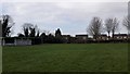

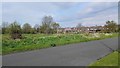
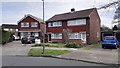
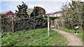
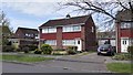
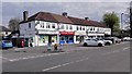
73 photos from this area
Area Information
Key information about the TW17 8SR including its size, population, and administrative classification.
- Area Type
- Postcode
- Area Size
- 5581 m²
- Population
- 1662
- Population Density
- 1811 people/km²
House Prices in TW17 8SR
12
Properties
£374,541
Average Sold Price
£87,500
Lowest Price
£580,000
Highest Price
Showing 12 properties
| Address | Type | Beds | Baths | Last Sale Price | Last Sale Date | |
|---|---|---|---|---|---|---|
| 18 Birch Grove, Shepperton, TW17 8SR | Bungalow | 2 | 1 | £445,000 | Apr 2024 | |
| 12 Birch Grove, Shepperton, TW17 8SR | Semi-detached | 3 | 1 | £525,000 | Jul 2023 | |
| 20 Birch Grove, Shepperton, TW17 8SR | Bungalow | - | - | £580,000 | Jun 2021 | |
| 4 Birch Grove, Shepperton, TW17 8SR | Bungalow | - | - | £375,000 | Nov 2020 | |
| 24 Birch Grove, Shepperton, TW17 8SR | Bungalow | - | - | £392,450 | Aug 2015 | |
| 2 Birch Grove, Shepperton, TW17 8SR | Semi-detached | 3 | 2 | £445,000 | Nov 2014 | |
| 10 Birch Grove, Shepperton, TW17 8SR | Bungalow | 3 | 1 | £536,000 | Aug 2014 | |
| 14 Birch Grove, Shepperton, TW17 8SR | Semi-detached | 3 | 3 | £230,000 | Feb 2009 | |
| 22 Birch Grove, Shepperton, TW17 8SR | Chalet | 2 | 2 | £294,000 | Nov 2006 | |
| 16 Birch Grove, Shepperton, TW17 8SR | Semi-detached | - | - | £210,000 | Dec 2001 |
Page 1 of 2
Energy Efficiency in TW17 8SR
Amenities
Schools
| Rank | School | Type | Entry gender | Ages |
|---|
Explore more schools in this area
Go to Schools tabDemographics
Household Size
One person
most common
Accommodation Type
Houses
most common
Tenure
74
majority
Ethnic Group
White
most common
Religion
N/A
most common
Household Composition
N/A
most common
Age
47
median
Adults (30-64 years)
most common
Household Deprivation
N/A
with no deprivation
NS-SEC
31
in Lower managerial occupations
Explore more demographic insights in this area
Go to Demographics tabPlanning
Planning Constraints
- Flood RiskPremium
- Ramsar Wetland SitesPremium
- Area of Outstanding Natural BeautyPremium
- Protected Nature ReservePremium
- Protected WoodlandPremium