Area Overview for TW17 8DR
Photos of TW17 8DR

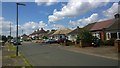
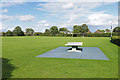
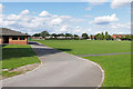

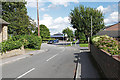
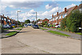
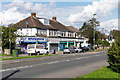
50 photos from this area
Area Information
Key information about the TW17 8DR including its size, population, and administrative classification.
- Area Type
- Postcode
- Area Size
- 3987 m²
- Population
- 1676
- Population Density
- 3254 people/km²
House Prices in TW17 8DR
13
Properties
£438,908
Average Sold Price
£236,000
Lowest Price
£840,000
Highest Price
Showing 13 properties
| Address | Type | Beds | Baths | Last Sale Price | Last Sale Date | |
|---|---|---|---|---|---|---|
| 24 Green Lane, Shepperton, TW17 8DR | Detached | 4 | 3 | £840,000 | Jan 2025 | |
| 44A Green Lane, Shepperton, TW17 8DR | Terraced | 2 | 1 | £357,500 | Aug 2020 | |
| 42 Green Lane, Shepperton, TW17 8DR | Terraced | 2 | 1 | £300,000 | Sep 2019 | |
| 26 Green Lane, Shepperton, TW17 8DR | Detached | 4 | 2 | £650,000 | Jul 2019 | |
| 42A Green Lane, Shepperton, TW17 8DR | Terraced | - | - | £249,950 | Mar 2008 | |
| 44 Green Lane, Shepperton, TW17 8DR | Terraced | - | - | £236,000 | Nov 2007 | |
| Flat 3, 34-40 Green Lane, Shepperton, TW17 8DR | Flat | - | 1 | - | - | |
| 32 Green Lane, Shepperton, TW17 8DR | Retail | 9 | 4 | - | - | |
| Flat, 32 Green Lane, Shepperton, TW17 8DR | Flat | - | - | - | - | |
| Flat 2, 34-40 Green Lane, Shepperton, TW17 8DR | Flat | - | - | - | - |
Page 1 of 2
Energy Efficiency in TW17 8DR
Amenities
Schools
| Rank | School | Type | Entry gender | Ages |
|---|
Explore more schools in this area
Go to Schools tabDemographics
Household Size
One person
most common
Accommodation Type
Houses
most common
Tenure
67
majority
Ethnic Group
White
most common
Religion
N/A
most common
Household Composition
N/A
most common
Age
47
median
Adults (30-64 years)
most common
Household Deprivation
N/A
with no deprivation
NS-SEC
39
in Lower managerial occupations
Explore more demographic insights in this area
Go to Demographics tabPlanning
Planning Constraints
- Flood RiskPremium
- Ramsar Wetland SitesPremium
- Area of Outstanding Natural BeautyPremium
- Protected Nature ReservePremium
- Protected WoodlandPremium