Area Overview for TW17 8BE
Photos of TW17 8BE
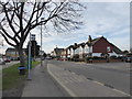
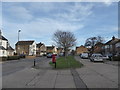
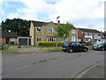
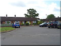
37 photos from this area
Area Information
Key information about the TW17 8BE including its size, population, and administrative classification.
- Area Type
- Postcode
- Area Size
- 1.1 hectares
- Population
- 1818
- Population Density
- 628 people/km²
House Prices in TW17 8BE
23
Properties
£472,875
Average Sold Price
£247,000
Lowest Price
£950,000
Highest Price
Showing 23 properties
| Address | Type | Beds | Baths | Last Sale Price | Last Sale Date | |
|---|---|---|---|---|---|---|
| 22 Lois Drive, Shepperton, TW17 8BE | Bungalow | 3 | 1 | £625,000 | Aug 2025 | |
| 12 Lois Drive, Shepperton, TW17 8BE | Bungalow | 3 | 2 | £650,000 | Oct 2024 | |
| 46 Lois Drive, Shepperton, TW17 8BE | Bungalow | 3 | - | £950,000 | Jun 2021 | |
| 26 Lois Drive, Shepperton, TW17 8BE | Bungalow | - | - | £665,000 | Mar 2021 | |
| 48 Lois Drive, Shepperton, TW17 8BE | Bungalow | - | - | £560,000 | Sep 2020 | |
| 16 Lois Drive, Shepperton, TW17 8BE | Bungalow | - | - | £485,000 | Jan 2016 | |
| 8 Lois Drive, Shepperton, TW17 8BE | Bungalow | - | - | £460,000 | Aug 2015 | |
| 28 Lois Drive, Shepperton, TW17 8BE | Bungalow | 3 | - | £474,000 | Mar 2014 | |
| 40 Lois Drive, Shepperton, TW17 8BE | Bungalow | 3 | 1 | £450,000 | Jun 2013 | |
| 18 Lois Drive, Shepperton, TW17 8BE | Bungalow | 2 | 1 | £315,000 | Oct 2012 |
Page 1 of 3
Energy Efficiency in TW17 8BE
Amenities
Schools
| Rank | School | Type | Entry gender | Ages |
|---|
Explore more schools in this area
Go to Schools tabDemographics
Household Size
Two person
most common
Accommodation Type
Houses
most common
Tenure
88
majority
Ethnic Group
White
most common
Religion
N/A
most common
Household Composition
N/A
most common
Age
47
median
Adults (30-64 years)
most common
Household Deprivation
N/A
with no deprivation
NS-SEC
46
in Lower managerial occupations
Explore more demographic insights in this area
Go to Demographics tabPlanning
Planning Constraints
- Flood RiskPremium
- Ramsar Wetland SitesPremium
- Area of Outstanding Natural BeautyPremium
- Protected Nature ReservePremium
- Protected WoodlandPremium