Area Overview for TW17 0RL
Photos of TW17 0RL
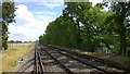
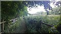
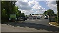
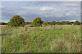
46 photos from this area
Area Information
Key information about the TW17 0RL including its size, population, and administrative classification.
- Area Type
- Postcode
- Area Size
- 1.5 hectares
- Population
- 1645
- Population Density
- 1282 people/km²
House Prices in TW17 0RL
14
Properties
£317,744
Average Sold Price
£59,500
Lowest Price
£450,000
Highest Price
Showing 14 properties
| Address | Type | Beds | Baths | Last Sale Price | Last Sale Date | |
|---|---|---|---|---|---|---|
| 143 Charlton Road, Shepperton, TW17 0RL | Semi-detached | 5 | 2 | £325,000 | Feb 2019 | |
| 145 Charlton Road, Shepperton, TW17 0RL | Semi-detached | 3 | - | £393,500 | Feb 2019 | |
| 159 Charlton Road, Shepperton, TW17 0RL | Semi-detached | 3 | 1 | £359,950 | Sep 2015 | |
| 161 Charlton Road, Shepperton, TW17 0RL | Semi-detached | 3 | 2 | £310,000 | Apr 2014 | |
| 149 Charlton Road, Shepperton, TW17 0RL | Semi-detached | 3 | - | £429,000 | Apr 2013 | |
| 149A Charlton Road, Shepperton, TW17 0RL | house | 3 | 3 | £450,000 | Oct 2012 | |
| 147 Charlton Road, Shepperton, TW17 0RL | Detached | 4 | 3 | £450,000 | Oct 2011 | |
| 151 Charlton Road, Shepperton, TW17 0RL | Semi-detached | 4 | 3 | £59,500 | Apr 1998 | |
| 157 Charlton Road, Shepperton, TW17 0RL | Semi-detached | - | - | £82,750 | May 1995 | |
| 147 Charlton Road, Shepperton, TW17 0RL | Semi-detached | - | - | - | - |
Page 1 of 2
Energy Efficiency in TW17 0RL
Amenities
Schools
| Rank | School | Type | Entry gender | Ages |
|---|
Explore more schools in this area
Go to Schools tabDemographics
Household Size
Family (3-5 people)
most common
Accommodation Type
Houses
most common
Tenure
86
majority
Ethnic Group
White
most common
Religion
N/A
most common
Household Composition
N/A
most common
Age
47
median
Adults (30-64 years)
most common
Household Deprivation
N/A
with no deprivation
NS-SEC
39
in Lower managerial occupations
Explore more demographic insights in this area
Go to Demographics tabPlanning
Planning Constraints
- Flood RiskPremium
- Ramsar Wetland SitesPremium
- Area of Outstanding Natural BeautyPremium
- Protected Nature ReservePremium
- Protected WoodlandPremium