Area Overview for Tunbridge Wells District (B)
Photos of Tunbridge Wells District (B)

Area Information
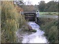
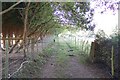
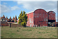
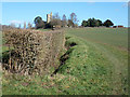
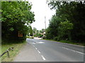
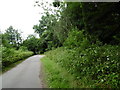
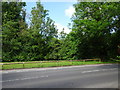
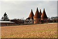
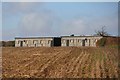
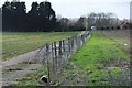
Living in Tunbridge Wells District (B) means residing within a local authority district that spans 331.3 km² of the Kent countryside. This extensive area covers what is known as The Weald, a region defined by its wooded characteristics and rural landscapes. You are not in a dense urban conurbation; instead, you inhabit a geographical unit established on 1 April 1974 by the Local Government Act 1972. The district merges the histories of Cranbrook Rural District, Tonbridge Rural District, Royal Tunbridge Wells Municipal Borough, and Southborough Urban District into a single modern entity. Its primary town, Royal Tunbridge Wells, received its borough charter status on 20 December 1974 and holds significant historical weight dating back to an Iron Age defensive hillfort at High Rocks. The district takes its name from Royal Tunbridge Wells, where a chalybeate spring was discovered in 1606 by Dudley North, 3rd Baron North. This discovery transformed the location from a hunting lodge site into a fashionable resort frequented by royalty, including Queen Victoria and Prince Albert. While the modern borough functions as an administrative centre and market town, its character remains deeply rooted in this heritage of wellness and tourism. The area offers a distinct lifestyle for those seeking a mix of regional authority governance and historic charm. You gain access to a broad territory that balances agricultural land with developed towns, providing a setting where the local government manages a wide swath of land in southwestern Kent.
- Area Type
- District/Borough
- Area Size
- 331.3 km²
- Population
- Not available
- Population Density
- Not available
Demographics
The community within Tunbridge Wells District (B) is defined by a notably older population profile across the entire area. The median age stands at 70, indicating that residents are significantly older than the national average. This demographic reality shapes the daily rhythm of the district, suggesting a society with ample leisure time but perhaps lower rates of young professional influx. When you consider who lives here, you find that the most common age range is simply recorded as 'Age: Total', reflecting the data's aggregation of the total population rather than specific sub-groups. Home ownership is a defining feature of life in this district, where 66% of households own their properties. This high percentage suggests a stable, settled community where long-term residents hold the keys to their homes. The data does not provide a breakdown of household composition by specific family types, religious affiliations, or predominant ethnic groups, but the 66% ownership figure heavily weights the socioeconomic landscape. A third of residents rent their homes, which may influence the type of accommodation available in the district. You should understand that the social fabric here is anchored by owner-occupiers, creating a distinct environment compared to high-rent urban zones. The lack of specific diversity metrics in the provided figures means the immediate picture focuses on age and tenure rather than complex cultural demographics.
Household Size
Accommodation Type
Tenure
Ethnic Group
Religion
Household Composition
Age
Household Deprivation
NS-SEC
Explore more demographic insights in this area
Go to Demographics tabPlanning
Planning Constraints
- Flood RiskPremium
- Ramsar Wetland SitesPremium
- Area of Outstanding Natural BeautyPremium
- Protected Nature ReservePremium
- Protected WoodlandPremium