Area Overview for Totton Central Ward
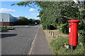
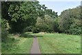
Photos of Totton Central Ward


Area Information
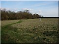
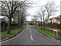
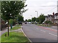
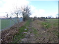
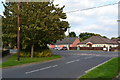
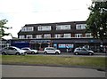
Totton Central Ward represents a compact district within the New Forest District Council area in Hampshire. This ward covers exactly 3.0 square kilometres and is home to 1,347 residents. Its small size creates a very close-knit environment where local geography defines daily routines. The area falls within the civil parish of Totton and Eling, connecting historical settlement patterns with modern domestic life. Your journey here involves navigating a landscape shaped by centuries of change, from the ancient settlement of Totinctone recorded in 985 to its official designation as England's largest village in 1974. Before that status, smaller communities like Testwood, Calmore, and Hammonds Green grew around it. Today, living in Totton Central Ward means residing in a borough unitary ward defined by New Forest District Council. The location sits near the New Forest, offering proximity to significant natural features while maintaining residential density. You are part of a civil parish that once hosted an Iron Age hillfort at Tatchbury Mount. Modern life here blends with this deep history, defined by specific boundaries that coincide with parts of Totton and Eling. When you consider the scale, you manage a community where every road and green space contributes to a tightly woven neighbourhood.
- Area Type
- District Borough Unitary Ward
- Area Size
- 3.0 km²
- Population
- 1347
- Population Density
- 453 people/km²
Demographics
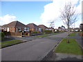
The community profile in Totton Central Ward reflects a stable, older population. Residents across the ward have a median age of 70 years, indicating a significant proportion of senior citizens call this area home. Demographic analysis shows the most common age category spans the total population, suggesting a homogeneous age structure rather than a balanced mix of families and singles. This demographic reality shapes local services and social interactions. Home ownership stands at an impressive 74 per cent of households. This high rate means you will find that over three quarters of properties are owner-occupied rather than rented. Such stability often contributes to quiet streets and long-term community ties. When evaluating household composition and accommodation types, the data indicates these metrics apply to the total ward population without specific splits provided. Diversity and religious affiliation data are not available for this specific ward, so the community feel relies heavily on the dominant age group rather than multicultural influences. The high ownership rate combined with the older median age paints a picture of a settled retirement community rather than a bustling family hub. You should approach demographics here with the understanding that stability and senior living define the social fabric.
Household Size
Accommodation Type
Tenure
Ethnic Group
Religion
Household Composition
Age
Household Deprivation
NS-SEC
Explore more demographic insights in this area
Go to Demographics tabPlanning
Planning Constraints
- Flood RiskPremium
- Ramsar Wetland SitesPremium
- Area of Outstanding Natural BeautyPremium
- Protected Nature ReservePremium
- Protected WoodlandPremium
- Crime RiskPremium