Area Overview for Totton
Photos of Totton


Area Information
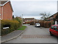
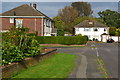
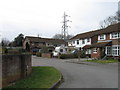
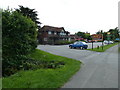
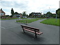
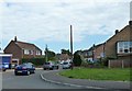
Living in Totton offers a defined character as a built-up area nestled within Hampshire. The locality covers seven point five square kilometres and serves a population of 8,698 residents. This density results in a community size that feels manageable yet established. You will find a settlement that operates like a traditional town with clear boundaries and a residential focus. Daily life here revolves around a compact footprint where most essentials are within walking or short driving distance. The area functions as a self-sufficient neighbourhood where the scale prevents the isolation often found in more rural settings. Residents appreciate the balance between urban convenience and a quieter pace of life compared to larger cities. Totton provides a practical living environment where you can access necessary services without navigating through congestion. The population density of 1,158 people per square kilometre ensures a sense of community without overwhelming population pressure. This specific size allows the area to maintain a distinct identity while remaining connected to wider networks. You will experience a locality where the built environment supports a steady, predictable rhythm of daily activities. Whether you are commuting or visiting local spots, the infrastructure is designed to serve this specific community size effectively.
- Area Type
- Built Up Area 250
- Area Size
- 7.5 km²
- Population
- 8698
- Population Density
- 1158 people/km²
Daily living in Totton is supported by a network of amenities that are within practical reach of your home. You have immediate access to retail options through five distinct retailers, including Morrisons Daily Totton 182, Morrisons Daily, and Co-op Totton. These venues cover groceries, household essentials, and daily necessities without requiring a long drive. Transport links are robust, with five railway stations nearby including Totton Railway Station, Redbridge Railway Station, and Ashurst New Forest Railway Station. This rail network connects you to Southampton and other major hubs efficiently. Beyond rail, there is a Coach Station available for bus travel and three ferry terminals offering connections to the island and continental Europe. Southampton Vehicle Ferry Terminal, Southampton Passenger Ferry Terminal, and Hythe Ferry Terminal provide diverse travel choices. These transport options mean commuting or leisure trips are flexible. Your lifestyle can involve a morning train to the city or an afternoon ferry cruise. The combination of shops, rail, and ferry options creates a versatile environment. You will find that convenience is built into the daily routine. Parking, walking distances, and public transport all contribute to a lifestyle that prioritises ease of movement and access to local services.
Amenities
Schools
Parents living in Totton have access to a range of primary education options, though secondary school data is not detailed in this local snapshot. The area features several infant schools which serve as key educational anchors for younger children. Hazel Wood Infant School holds an outstanding Ofsted rating, providing top-tier education for early learners. Lydlynch Infant School and Calmore Infant School both carry a good rating, ensuring quality foundational learning. Eling Infant School and Nursery also operates with a good rating, combining education and childcare services. Oakfield Primary School is listed as an educational provider, though its specific Ofsted rating is not recorded in the available information. This mix of schools means you can find a variety of learning environments within practical reach. The presence of multiple infant schools suggests a designation for very young children, as there are no secondary institutions listed in the provided data. Families may need to look further for older children, but the infant sector is robust. The good and outstanding ratings indicate a commitment to quality in the early years. If you are assessing living in Totton for family reasons, take note that this is predominantly an infant and primary school zone. The consistency of ratings across the board provides reassurance that the educational foundation is sound for any child born or moving into this neighbourhood.
| Rank | School | Type | Entry gender | Ages |
|---|
Explore more schools in this area
Go to Schools tabDemographics
The community profile in Totton reveals an older population with distinct ownership traits. The median age stands at 70 years, indicating that residents are significantly older than the national average for England. This age distribution shapes the local culture, purchasing habits, and the type of services requested within the borough. You will find that the majority of households are owner-occupied, with a figure of 73 per cent. This high level of home ownership suggests long-term stability and residents who have invested deeply in their local properties over many years. Household composition reflects this demographic reality, favouring single-person households or older couples rather than young families with children. The accommodation types present are largely suited to established needs, featuring properties that have stood for decades. You will not find a high concentration of student accommodation or temporary rentals. The population lacks specific ethnic predominance data, which means the area is likely diverse but defined more by age and tenure than recent migration trends. Reliability in local services is a priority for residents in this age bracket. The demographic mix creates a stable environment where community leaders and local organisations have known constituents for extended periods.
Household Size
Accommodation Type
Tenure
Ethnic Group
Religion
Household Composition
Age
Household Deprivation
NS-SEC
Explore more demographic insights in this area
Go to Demographics tabPlanning
Planning Constraints
- Crime RiskPremium