Area Overview for Totland
Photos of Totland


Area Information
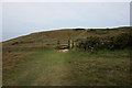
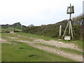
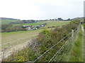
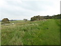
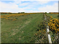
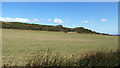
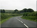
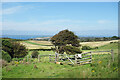
Totland presents itself as a small, established civil parish in England, covering an area of 5.5 km². This compact footprint defines the local landscape and limits the scale of development. You will find a community deeply rooted in its surroundings, where daily life moves at a pace dictated by the perimeter of the parish rather than city grids. The distinct identity of Totland comes from its controlled size, which fosters a specific type of settlement character for those choosing to live here. Residents benefit from a defined environment where the boundaries are clear and the locality feels manageable. When you look for homes in Totland, you are entering a space where the civil parish status ensures a certain level of administrative structure and local governance. The area is not sprawling; it is concentrated, which means amenities and neighbours are relatively close together. Living in Totland offers a lifestyle where the physical scale of the territory sets the tone for the experience. The 5.5 km² boundary acts as a natural container for the population, shaping the rhythm of everyday activities. Prospective buyers should understand that this specific spatial constraint is a defining feature of what you own and where you spend your time. The parish structure provides a stable background for those seeking a settled pace of life without the expansion of larger urban zones.
- Area Type
- Parish
- Area Size
- 5.5 km²
- Population
- Not available
- Population Density
- Not available
Demographics
The community profile of Totland reflects a settled, mature population structure. With a median age of 70 years, the residents are predominantly older adults. This demographic concentration suggests a neighbourhood where many people have remained for their entire lives or arrived in retirement. The age distribution indicates that families with young children may find fewer peers in the immediate vicinity compared to younger regions. Home ownership stands at 74%, which confirms that the vast majority of residents own their properties outright or with a mortgage. This high rate of ownership underscores the stability of the household composition within the parish. You will encounter households that are likely multi-generational or empty-nester couples, consistent with an older population centre. The accommodation types in Totland align with this ownership model, creating a stock favoured by long-term residents rather than short-term tenants. While specific details on ethnicity and religion are not granular in the current dataset, the overwhelming presence of owner-occupied homes points to a homogenous sense of attachment to the land. The household makeup is dominated by these owner-occupiers, meaning the social fabric is built on shared tenure. When considering who lives near you, expect a demographic where permanence is the norm. The age and ownership figures combine to create a quiet, established atmosphere where community interactions are often neighbourly and long-standing.
Household Size
Accommodation Type
Tenure
Ethnic Group
Religion
Household Composition
Age
Household Deprivation
NS-SEC
Explore more demographic insights in this area
Go to Demographics tabPlanning
Planning Constraints
- Flood RiskPremium
- Ramsar Wetland SitesPremium
- Area of Outstanding Natural BeautyPremium
- Protected Nature ReservePremium
- Protected WoodlandPremium
- Crime RiskPremium