Area Overview for Tongham
Photos of Tongham


Area Information
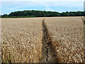
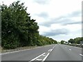
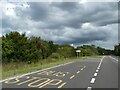
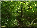
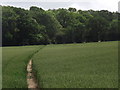
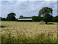
Tongham is a small civil parish located in north-east Surrey, England, with a total land area of 3.3 km². The village forms a triangle situated between the A31 and A331 roads, positioning it approximately 1½ miles south-east of Aldershot in Hampshire and north-east of Farnham. According to 2021 data, the population stands at 2,350 residents, a demographic that combines historical roots with recent residential growth. Archaeological evidence confirms occupation since Neolithic times, with Iron Age farmsteads remaining in the landscape. St. Paul's Church, designed by Ewan Christian, was completed in 1865 and remains a key landmark alongside the Historic Hogs Back Brewery located just north of the Hog's Back. Living in Tongham offers a distinct community feel, though this sense of locality faces pressure from ongoing development. Several new residential projects are underway, including a notable planning application submitted in December 2025 by Taylor Wimpey for 450 homes on greenfield land. This expansion reflects the parish's fast-growing status while raising local concerns about maintaining the village's identity. Historically, the area played a significant role during the development of the Aldershot military camp, which the village railway station served from 1856 until 1870. Today, the parish falls under the administrative jurisdiction of Guildford Borough Council and Surrey County Council. Whether you research schools near Tongham or consider life in these Surrey homes, you are entering an area defined by its rural character, historic ties to Aldershot, and a tangible sense of place.
- Area Type
- Parish
- Area Size
- 3.3 km²
- Population
- Not available
- Population Density
- Not available
Demographics
The community in Tongham displays a unique demographic profile characterised by an older population. The median age is 70 years, indicating a significant proportion of residents are elderly. While the provided data does not specify the breakdown within specific age brackets beyond the total, the figure suggests a retirement-focused settlement where many homes in Tongham are occupied by those born in earlier decades. Home ownership is prevalent, with 73% of households owning their property outright or with a mortgage. This high rate of ownership typically contributes to a stable community environment where long-term residents have deep local knowledge. Regarding household composition and accommodation types, the available statistics cover the total population but do not provide granular details on family versus single-person households. The predominance of older residents often correlates with smaller household sizes or single-person dwellings. In terms of diversity, the dataset lists the predominant ethnic group, religion, and household composition simply as "total," leading to a demographic picture that appears largely uniform. This homogeneity often aligns with rural villages in the south-east of England. Safety assessments further reinforce the stability of living in Tongham, with a crime risk score of 70/100 indicating below-average crime rates. For those considering homes in Tongham, the demographic mix suggests a quiet, established neighbourhood where the community fabric is anchored by an older, settled population rather than a transient workforce or young families seeking rapid change.
Household Size
Accommodation Type
Tenure
Ethnic Group
Religion
Household Composition
Age
Household Deprivation
NS-SEC
Explore more demographic insights in this area
Go to Demographics tabPlanning
Planning Constraints
- Flood RiskPremium
- Ramsar Wetland SitesPremium
- Area of Outstanding Natural BeautyPremium
- Protected Nature ReservePremium
- Protected WoodlandPremium