Area Overview for TN8 6LD
Photos of TN8 6LD


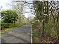
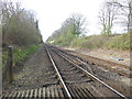
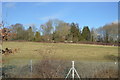
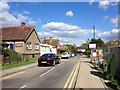
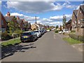
87 photos from this area
Area Information
Key information about the TN8 6LD including its size, population, and administrative classification.
- Area Type
- Postcode
- Area Size
- 13.6 hectares
- Population
- 2027
- Population Density
- 358 people/km²
House Prices in TN8 6LD
14
Properties
£521,246
Average Sold Price
£165,000
Lowest Price
£1,500,000
Highest Price
Showing 14 properties
| Address | Type | Beds | Baths | Last Sale Price | Last Sale Date | |
|---|---|---|---|---|---|---|
| Ashcombe, Hilders Lane, Edenbridge, TN8 6LD | Detached | 3 | 4 | £1,500,000 | Nov 2023 | |
| 1, Hardings Cottages, Hilders Lane, Edenbridge, TN8 6LD | Detached | 3 | 1 | £500,000 | Jun 2020 | |
| Fern Cottage, Hilders Lane, Edenbridge, TN8 6LD | Detached | 3 | 1 | £550,000 | May 2020 | |
| 1, Hope Cottages, Hilders Lane, Edenbridge, TN8 6LD | Semi-detached | 3 | 1 | £440,000 | Feb 2020 | |
| Pond Cottage, Hilders Lane, Edenbridge, TN8 6LD | Detached | 4 | 2 | £785,000 | Dec 2019 | |
| 2, Hardings Cottages, Hilders Lane, Edenbridge, TN8 6LD | Detached | 2 | 1 | £530,000 | Aug 2019 | |
| White Gates, Hilders Lane, Edenbridge, TN8 6LD | Detached | 3 | 1 | £435,000 | Jul 2015 | |
| 2, Hope Cottages, Hilders Lane, Edenbridge, TN8 6LD | Semi-detached | 3 | 2 | £330,000 | Nov 2013 | |
| Yew Cottage, Hilders Lane, Edenbridge, TN8 6LD | house | 4 | - | £585,000 | Nov 2012 | |
| Cedar Cottage, Hilders Lane, Edenbridge, TN8 6LD | Detached | - | - | £235,000 | Aug 2008 |
Page 1 of 2
Energy Efficiency in TN8 6LD
Amenities
Schools
| Rank | School | Type | Entry gender | Ages |
|---|
Explore more schools in this area
Go to Schools tabDemographics
Household Size
Two person
most common
Accommodation Type
Houses
most common
Tenure
82
majority
Ethnic Group
White
most common
Religion
N/A
most common
Household Composition
N/A
most common
Age
47
median
Adults (30-64 years)
most common
Household Deprivation
N/A
with no deprivation
NS-SEC
44
in Lower managerial occupations
Explore more demographic insights in this area
Go to Demographics tabPlanning
Planning Constraints
- Flood RiskPremium
- Ramsar Wetland SitesPremium
- Area of Outstanding Natural BeautyPremium
- Protected Nature ReservePremium
- Protected WoodlandPremium