Area Overview for TN6 2PD
Photos of TN6 2PD
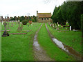
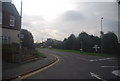
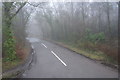

20 photos from this area
Area Information
Key information about the TN6 2PD including its size, population, and administrative classification.
- Area Type
- Postcode
- Area Size
- 9958 m²
- Population
- 1999
- Population Density
- 5395 people/km²
House Prices in TN6 2PD
18
Properties
£324,986
Average Sold Price
£195,000
Lowest Price
£499,950
Highest Price
Showing 18 properties
| Address | Type | Beds | Baths | Last Sale Price | Last Sale Date | |
|---|---|---|---|---|---|---|
| Figg Lodge, Figg Lane, Crowborough, TN6 2PD | house | 3 | - | £499,950 | Oct 2022 | |
| Poonamalie, Figg Lane, Crowborough, TN6 2PD | Retail | 2 | - | £395,000 | Sep 2022 | |
| Byways, Figg Lane, Crowborough, TN6 2PD | Semi-detached | 3 | 1 | £290,000 | Aug 2018 | |
| Fallowfield, Figg Lane, Crowborough, TN6 2PD | Bungalow | 2 | 1 | £275,000 | Sep 2015 | |
| Linden, Figg Lane, Crowborough, TN6 2PD | Bungalow | - | - | £293,000 | Sep 2006 | |
| Heather Dene, Figg Lane, Crowborough, TN6 2PD | Semi-detached | - | - | £195,000 | Nov 2003 | |
| Nethania House, Figg Lane, Crowborough, TN6 2PD | house | - | - | £326,950 | Nov 2003 | |
| Casinha, Figg Lane, Crowborough, TN6 2PD | Bungalow | 2 | 1 | - | - | |
| Annexe, Linden, Figg Lane, Crowborough, TN6 2PD | Bungalow | 2 | 1 | - | - | |
| Nirvana, Figg Lane, Crowborough, TN6 2PD | house | 4 | - | - | - |
Page 1 of 2
Energy Efficiency in TN6 2PD
Amenities
Schools
| Rank | School | Type | Entry gender | Ages |
|---|
Explore more schools in this area
Go to Schools tabDemographics
Household Size
Two person
most common
Accommodation Type
Houses
most common
Tenure
73
majority
Ethnic Group
White
most common
Religion
N/A
most common
Household Composition
N/A
most common
Age
47
median
Adults (30-64 years)
most common
Household Deprivation
N/A
with no deprivation
NS-SEC
38
in Lower managerial occupations
Explore more demographic insights in this area
Go to Demographics tabPlanning
Planning Constraints
- Flood RiskPremium
- Ramsar Wetland SitesPremium
- Area of Outstanding Natural BeautyPremium
- Protected Nature ReservePremium
- Protected WoodlandPremium