Area Overview for TN5 6EW
Photos of TN5 6EW

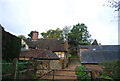
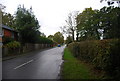
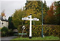
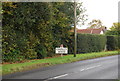
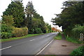
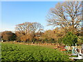
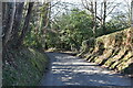
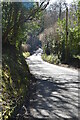
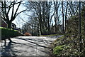
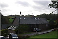
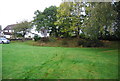
44 photos from this area
Area Information
Key information about the TN5 6EW including its size, population, and administrative classification.
- Area Type
- Postcode
- Area Size
- 34.1 hectares
- Population
- 1739
- Population Density
- 76 people/km²
House Prices in TN5 6EW
17
Properties
£968,500
Average Sold Price
£235,000
Lowest Price
£3,000,000
Highest Price
Showing 17 properties
| Address | Type | Beds | Baths | Last Sale Price | Last Sale Date | |
|---|---|---|---|---|---|---|
| Monks Grange, Monks Lane, Cousley Wood, Wadhurst, TN5 6EW | house | - | - | £3,000,000 | Sep 2021 | |
| Monks Wood Farm, Monks Lane, Cousley Wood, Wadhurst, TN5 6EW | Detached | 7 | 5 | £1,350,000 | Jul 2020 | |
| 1, Hillside, Monks Lane, Cousley Wood, Wadhurst, TN5 6EW | Terraced | 2 | 1 | £437,000 | Jun 2019 | |
| Nutlands, Monks Lane, Cousley Wood, Wadhurst, TN5 6EW | house | 3 | 2 | £640,000 | Aug 2013 | |
| 4, Hillside, Monks Lane, Cousley Wood, Wadhurst, TN5 6EW | Terraced | 5 | 3 | £235,000 | Dec 2005 | |
| Linden House, Monks Lane, Cousley Wood, Wadhurst, TN5 6EW | Detached | - | - | £820,000 | Jul 2001 | |
| Old Monks, Monks Lane, Cousley Wood, Wadhurst, TN5 6EW | house | - | - | £297,500 | Jun 1995 | |
| Mobile Home 2, Leeland, Monks Lane, Cousley Wood, Wadhurst, TN5 6EW | Mobile Home | - | - | - | - | |
| Keepers Lodge, Monks Lane, Cousley Wood, Wadhurst, TN5 6EW | Bungalow | - | - | - | - | |
| Leeland, Monks Lane, Cousley Wood, Wadhurst, TN5 6EW | Mobile Home | - | - | - | - |
Page 1 of 2
Energy Efficiency in TN5 6EW
Amenities
Schools
| Rank | School | Type | Entry gender | Ages |
|---|
Explore more schools in this area
Go to Schools tabDemographics
Household Size
Two person
most common
Accommodation Type
Houses
most common
Tenure
89
majority
Ethnic Group
White
most common
Religion
N/A
most common
Household Composition
N/A
most common
Age
47
median
Adults (30-64 years)
most common
Household Deprivation
N/A
with no deprivation
NS-SEC
52
in Lower managerial occupations
Explore more demographic insights in this area
Go to Demographics tabPlanning
Planning Constraints
- Flood RiskPremium
- Ramsar Wetland SitesPremium
- Area of Outstanding Natural BeautyPremium
- Protected Nature ReservePremium
- Protected WoodlandPremium