Area Overview for TN4 9XL
Photos of TN4 9XL
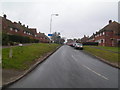
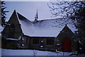
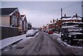
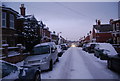
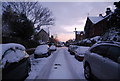

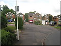
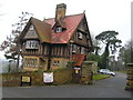
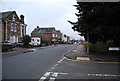

100 photos from this area
Area Information
Key information about the TN4 9XL including its size, population, and administrative classification.
- Area Type
- Postcode
- Area Size
- 69.4 hectares
- Population
- 1858
- Population Density
- 1198 people/km²
House Prices in TN4 9XL
14
Properties
£306,667
Average Sold Price
£210,000
Lowest Price
£390,000
Highest Price
Showing 14 properties
| Address | Type | Beds | Baths | Last Sale Price | Last Sale Date | |
|---|---|---|---|---|---|---|
| Beech House, Reynolds Lane, Royal Tunbridge Wells, TN4 9XL | house | - | - | £390,000 | Apr 2001 | |
| Willow Cottage, Reynolds Lane, Royal Tunbridge Wells, TN4 9XL | house | - | - | £210,000 | Jul 2000 | |
| Orchard House, Reynolds Lane, Royal Tunbridge Wells, TN4 9XL | Semi-detached | - | - | £320,000 | Jul 2000 | |
| Oaklea, Reynolds Lane, Royal Tunbridge Wells, TN4 9XL | Detached | 4 | 2 | - | - | |
| High Croft, The Rocks, Reynolds Lane, Royal Tunbridge Wells, TN4 9XL | Retail | 5 | 4 | - | - | |
| Smockham Farm, Reynolds Lane, Royal Tunbridge Wells, TN4 9XL | Land | 6 | 3 | - | - | |
| Little Knoll, Reynolds Lane, Royal Tunbridge Wells, TN4 9XL | Detached | 4 | 2 | - | - | |
| Fern Lodge, The Rocks, Reynolds Lane, Royal Tunbridge Wells, TN4 9XL | Industrial | - | - | - | - | |
| Mobile Home, The Rocks, Reynolds Lane, Royal Tunbridge Wells, TN4 9XL | Mobile Home | - | - | - | - | |
| The Hay Barn, Smockham Farm, Reynolds Lane, Royal Tunbridge Wells, TN4 9XL | house | - | - | - | - |
Page 1 of 2
Energy Efficiency in TN4 9XL
Amenities
Schools
| Rank | School | Type | Entry gender | Ages |
|---|
Explore more schools in this area
Go to Schools tabDemographics
Household Size
Family (3-5 people)
most common
Accommodation Type
Houses
most common
Tenure
81
majority
Ethnic Group
White
most common
Religion
N/A
most common
Household Composition
N/A
most common
Age
47
median
Adults (30-64 years)
most common
Household Deprivation
N/A
with no deprivation
NS-SEC
47
in Lower managerial occupations
Explore more demographic insights in this area
Go to Demographics tabPlanning
Planning Constraints
- Flood RiskPremium
- Ramsar Wetland SitesPremium
- Area of Outstanding Natural BeautyPremium
- Protected Nature ReservePremium
- Protected WoodlandPremium