Area Overview for TN4 9PH
Photos of TN4 9PH

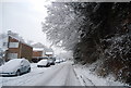


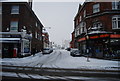


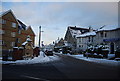

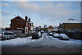

100 photos from this area
Area Information
Key information about the TN4 9PH including its size, population, and administrative classification.
- Area Type
- Postcode
- Area Size
- 1.0 hectares
- Population
- 1765
- Population Density
- 3132 people/km²
House Prices in TN4 9PH
41
Properties
£773,364
Average Sold Price
£115,000
Lowest Price
£975,000
Highest Price
Showing 41 properties
| Address | Type | Beds | Baths | Last Sale Price | Last Sale Date | |
|---|---|---|---|---|---|---|
| 98 St Johns Road, Royal Tunbridge Wells, TN4 9PH | Terraced | 4 | 3 | £975,000 | May 2024 | |
| 110A St Johns Road, Royal Tunbridge Wells, TN4 9PH | Detached | 4 | 1 | £915,000 | Dec 2021 | |
| 90 St Johns Road, Royal Tunbridge Wells, TN4 9PH | house | - | - | £940,000 | Aug 2021 | |
| 88 St Johns Road, Royal Tunbridge Wells, TN4 9PH | house | - | - | £930,000 | Jun 2021 | |
| 94 St Johns Road, Royal Tunbridge Wells, TN4 9PH | house | - | - | £935,000 | Jun 2021 | |
| 92 St Johns Road, Royal Tunbridge Wells, TN4 9PH | Semi-detached | 4 | 3 | £925,000 | Jun 2021 | |
| 96 St Johns Road, Royal Tunbridge Wells, TN4 9PH | Detached | 4 | 3 | £920,000 | Oct 2020 | |
| 116 St Johns Road, Royal Tunbridge Wells, TN4 9PH | house | - | - | £860,000 | Apr 2020 | |
| 112 St Johns Road, Royal Tunbridge Wells, TN4 9PH | Detached | - | - | £472,000 | May 2007 | |
| 118 St Johns Road, Royal Tunbridge Wells, TN4 9PH | Detached | - | - | £520,000 | May 2006 |
Page 1 of 5
Energy Efficiency in TN4 9PH
Amenities
Schools
| Rank | School | Type | Entry gender | Ages |
|---|
Explore more schools in this area
Go to Schools tabDemographics
Household Size
Family (3-5 people)
most common
Accommodation Type
Houses
most common
Tenure
70
majority
Ethnic Group
White
most common
Religion
N/A
most common
Household Composition
N/A
most common
Age
47
median
Adults (30-64 years)
most common
Household Deprivation
N/A
with no deprivation
NS-SEC
52
in Lower managerial occupations
Explore more demographic insights in this area
Go to Demographics tabPlanning
Planning Constraints
- Flood RiskPremium
- Ramsar Wetland SitesPremium
- Area of Outstanding Natural BeautyPremium
- Protected Nature ReservePremium
- Protected WoodlandPremium