Area Overview for TN4 8UR
Photos of TN4 8UR
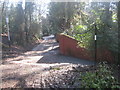
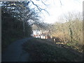
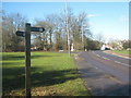
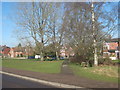
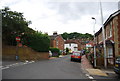
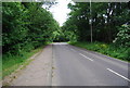
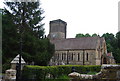
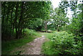
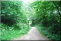
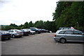
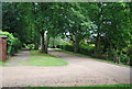
100 photos from this area
Area Information
Key information about the TN4 8UR including its size, population, and administrative classification.
- Area Type
- Postcode
- Area Size
- 3587 m²
- Population
- 1625
- Population Density
- 5740 people/km²
House Prices in TN4 8UR
23
Properties
£262,960
Average Sold Price
£65,000
Lowest Price
£450,000
Highest Price
Showing 23 properties
| Address | Type | Beds | Baths | Last Sale Price | Last Sale Date | |
|---|---|---|---|---|---|---|
| 6 Erskine Park Road, Rusthall, Tunbridge Wells, TN4 8UR | Semi-detached | 3 | 1 | £437,000 | Jul 2023 | |
| 22 Erskine Park Road, Rusthall, Tunbridge Wells, TN4 8UR | Semi-detached | 2 | 1 | £340,000 | Dec 2021 | |
| 38 Erskine Park Road, Rusthall, Tunbridge Wells, TN4 8UR | Semi-detached | 3 | 3 | £415,000 | Mar 2021 | |
| 2 Erskine Park Road, Rusthall, Tunbridge Wells, TN4 8UR | Semi-detached | 4 | 2 | £450,000 | Mar 2020 | |
| 8 Erskine Park Road, Rusthall, Tunbridge Wells, TN4 8UR | Semi-detached | 2 | 1 | £330,000 | Aug 2016 | |
| 44 Erskine Park Road, Rusthall, Tunbridge Wells, TN4 8UR | Semi-detached | 2 | - | £274,000 | Aug 2014 | |
| 42 Erskine Park Road, Rusthall, Tunbridge Wells, TN4 8UR | Semi-detached | 2 | - | £239,495 | Oct 2013 | |
| 30 Erskine Park Road, Rusthall, Tunbridge Wells, TN4 8UR | Semi-detached | 3 | - | £240,000 | Mar 2008 | |
| 28 Erskine Park Road, Rusthall, Tunbridge Wells, TN4 8UR | house | - | - | £227,000 | Aug 2005 | |
| 10 Erskine Park Road, Rusthall, Tunbridge Wells, TN4 8UR | house | - | - | £215,000 | Aug 2005 |
Page 1 of 3
Energy Efficiency in TN4 8UR
Amenities
Schools
| Rank | School | Type | Entry gender | Ages |
|---|
Explore more schools in this area
Go to Schools tabDemographics
Household Size
Family (3-5 people)
most common
Accommodation Type
Houses
most common
Tenure
79
majority
Ethnic Group
White
most common
Religion
N/A
most common
Household Composition
N/A
most common
Age
47
median
Adults (30-64 years)
most common
Household Deprivation
N/A
with no deprivation
NS-SEC
41
in Lower managerial occupations
Explore more demographic insights in this area
Go to Demographics tabPlanning
Planning Constraints
- Flood RiskPremium
- Ramsar Wetland SitesPremium
- Area of Outstanding Natural BeautyPremium
- Protected Nature ReservePremium
- Protected WoodlandPremium