Area Overview for TN4 8TX
Photos of TN4 8TX
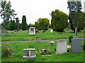
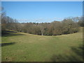
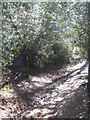
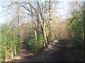
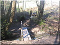
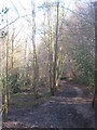
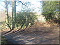
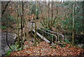
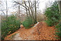
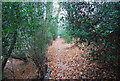
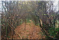
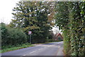
92 photos from this area
Area Information
Key information about the TN4 8TX including its size, population, and administrative classification.
- Area Type
- Postcode
- Area Size
- 9908 m²
- Population
- 1625
- Population Density
- 5740 people/km²
House Prices in TN4 8TX
24
Properties
£361,625
Average Sold Price
£86,500
Lowest Price
£632,500
Highest Price
Showing 24 properties
| Address | Type | Beds | Baths | Last Sale Price | Last Sale Date | |
|---|---|---|---|---|---|---|
| 57 Westwood Road, Rusthall, Tunbridge Wells, TN4 8TX | Terraced | 4 | - | £632,500 | Jan 2023 | |
| 45 Westwood Road, Rusthall, Tunbridge Wells, TN4 8TX | house | - | - | £425,000 | Jun 2021 | |
| 59 Westwood Road, Rusthall, Tunbridge Wells, TN4 8TX | Semi-detached | 5 | 1 | £483,000 | Jun 2019 | |
| 49 Westwood Road, Rusthall, Tunbridge Wells, TN4 8TX | Terraced | 4 | - | £399,000 | Sep 2016 | |
| 23 Westwood Road, Rusthall, Tunbridge Wells, TN4 8TX | house | - | - | £373,500 | Jun 2016 | |
| 21 Westwood Road, Rusthall, Tunbridge Wells, TN4 8TX | house | - | - | £367,500 | Sep 2015 | |
| 53 Westwood Road, Rusthall, Tunbridge Wells, TN4 8TX | Semi-detached | 4 | 1 | £368,000 | Nov 2014 | |
| 27 Westwood Road, Rusthall, Tunbridge Wells, TN4 8TX | house | 3 | - | £295,000 | Aug 2011 | |
| 37 Westwood Road, Rusthall, Tunbridge Wells, TN4 8TX | Semi-detached | - | - | £282,500 | Jul 2007 | |
| 43 Westwood Road, Rusthall, Tunbridge Wells, TN4 8TX | Terraced | - | - | £381,000 | May 2007 |
Page 1 of 3
Energy Efficiency in TN4 8TX
Amenities
Schools
| Rank | School | Type | Entry gender | Ages |
|---|
Explore more schools in this area
Go to Schools tabDemographics
Household Size
Family (3-5 people)
most common
Accommodation Type
Houses
most common
Tenure
79
majority
Ethnic Group
White
most common
Religion
N/A
most common
Household Composition
N/A
most common
Age
47
median
Adults (30-64 years)
most common
Household Deprivation
N/A
with no deprivation
NS-SEC
41
in Lower managerial occupations
Explore more demographic insights in this area
Go to Demographics tabPlanning
Planning Constraints
- Flood RiskPremium
- Ramsar Wetland SitesPremium
- Area of Outstanding Natural BeautyPremium
- Protected Nature ReservePremium
- Protected WoodlandPremium