Area Overview for TN4 0UT
Photos of TN4 0UT
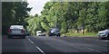
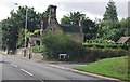
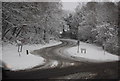
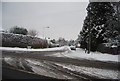
100 photos from this area
Area Information
Key information about the TN4 0UT including its size, population, and administrative classification.
- Area Type
- Postcode
- Area Size
- 5.0 hectares
- Population
- 1623
- Population Density
- 163 people/km²
House Prices in TN4 0UT
21
Properties
£960,423
Average Sold Price
£223,500
Lowest Price
£1,725,000
Highest Price
Showing 21 properties
| Address | Type | Beds | Baths | Last Sale Price | Last Sale Date | |
|---|---|---|---|---|---|---|
| 1A Bidborough Ridge, Bidborough, Tunbridge Wells, TN4 0UT | Detached | 7 | 3 | £1,002,000 | Feb 2024 | |
| 23 Bidborough Ridge, Bidborough, Tunbridge Wells, TN4 0UT | Detached | 4 | 2 | £1,400,000 | Nov 2022 | |
| North Point, 31 Bidborough Ridge, Bidborough, Tunbridge Wells, TN4 0UT | house | - | - | £1,725,000 | Dec 2021 | |
| 33 Bidborough Ridge, Bidborough, Tunbridge Wells, TN4 0UT | Detached | 4 | 2 | £1,120,000 | Feb 2019 | |
| 29 Bidborough Ridge, Bidborough, Tunbridge Wells, TN4 0UT | Detached | 5 | 1 | £1,150,000 | May 2018 | |
| Windrush, 5 Bidborough Ridge, Bidborough, Tunbridge Wells, TN4 0UT | house | - | - | £1,225,000 | Nov 2015 | |
| 1 Bidborough Ridge, Bidborough, Tunbridge Wells, TN4 0UT | Detached | 5 | 3 | £780,000 | Jan 2015 | |
| 17 Bidborough Ridge, Bidborough, Tunbridge Wells, TN4 0UT | house | - | - | £1,250,000 | Oct 2014 | |
| 27 Bidborough Ridge, Bidborough, Tunbridge Wells, TN4 0UT | house | 5 | - | £870,000 | May 2012 | |
| 35 Bidborough Ridge, Bidborough, Tunbridge Wells, TN4 0UT | Detached | - | - | £800,000 | Jul 2009 |
Page 1 of 3
Energy Efficiency in TN4 0UT
Amenities
Schools
| Rank | School | Type | Entry gender | Ages |
|---|
Explore more schools in this area
Go to Schools tabDemographics
Household Size
Family (3-5 people)
most common
Accommodation Type
Houses
most common
Tenure
82
majority
Ethnic Group
White
most common
Religion
N/A
most common
Household Composition
N/A
most common
Age
47
median
Adults (30-64 years)
most common
Household Deprivation
N/A
with no deprivation
NS-SEC
53
in Lower managerial occupations
Explore more demographic insights in this area
Go to Demographics tabPlanning
Planning Constraints
- Flood RiskPremium
- Ramsar Wetland SitesPremium
- Area of Outstanding Natural BeautyPremium
- Protected Nature ReservePremium
- Protected WoodlandPremium