Area Overview for TN39 4AE
Photos of TN39 4AE
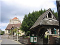
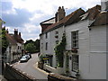
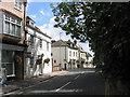

82 photos from this area
Area Information
Key information about the TN39 4AE including its size, population, and administrative classification.
- Area Type
- Postcode
- Area Size
- 1.0 hectares
- Population
- 1705
- Population Density
- 1526 people/km²
House Prices in TN39 4AE
27
Properties
£165,939
Average Sold Price
£69,950
Lowest Price
£285,000
Highest Price
Showing 27 properties
| Address | Type | Beds | Baths | Last Sale Price | Last Sale Date | |
|---|---|---|---|---|---|---|
| 219 London Road, Bexhill, TN39 4AE | house | 3 | 1 | £285,000 | Dec 2022 | |
| 200 London Road, Bexhill, TN39 4AE | Terraced | 3 | 1 | £281,000 | Aug 2021 | |
| 188 London Road, Bexhill, TN39 4AE | house | - | - | £268,000 | Jan 2021 | |
| 204 London Road, Bexhill, TN39 4AE | Terraced | 2 | - | £165,000 | Nov 2016 | |
| 221 London Road, Bexhill, TN39 4AE | house | - | - | £132,500 | Aug 2011 | |
| 196 London Road, Bexhill, TN39 4AE | house | - | - | £128,000 | Oct 2006 | |
| 190 London Road, Bexhill, TN39 4AE | house | - | - | £86,000 | May 2001 | |
| 184 London Road, Bexhill, TN39 4AE | Semi-detached | - | - | £78,000 | Aug 2000 | |
| 186 London Road, Bexhill, TN39 4AE | house | 3 | - | £69,950 | Aug 2000 | |
| Flat 7, Kimberley Court, 231-233 London Road, Bexhill, TN39 4AE | Flat | 1 | 1 | - | - |
Page 1 of 3
Energy Efficiency in TN39 4AE
Amenities
Schools
| Rank | School | Type | Entry gender | Ages |
|---|
Explore more schools in this area
Go to Schools tabDemographics
Household Size
Two person
most common
Accommodation Type
Houses
most common
Tenure
73
majority
Ethnic Group
White
most common
Religion
N/A
most common
Household Composition
N/A
most common
Age
47
median
Adults (30-64 years)
most common
Household Deprivation
N/A
with no deprivation
NS-SEC
30
in Lower managerial occupations
Explore more demographic insights in this area
Go to Demographics tabPlanning
Planning Constraints
- Flood RiskPremium
- Ramsar Wetland SitesPremium
- Area of Outstanding Natural BeautyPremium
- Protected Nature ReservePremium
- Protected WoodlandPremium