Area Overview for TN38 8DG
Photos of TN38 8DG


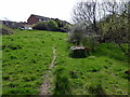
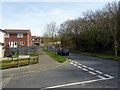
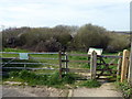


55 photos from this area
Area Information
Key information about the TN38 8DG including its size, population, and administrative classification.
- Area Type
- Postcode
- Area Size
- 1.9 hectares
- Population
- 1900
- Population Density
- 1053 people/km²
House Prices in TN38 8DG
40
Properties
£207,239
Average Sold Price
£58,950
Lowest Price
£385,000
Highest Price
Showing 40 properties
| Address | Type | Beds | Baths | Last Sale Price | Last Sale Date | |
|---|---|---|---|---|---|---|
| 6 Bunting Close, St Leonards On Sea, TN38 8DG | Bungalow | 2 | 1 | £260,000 | Sep 2025 | |
| 16 Bunting Close, St Leonards On Sea, TN38 8DG | Detached | 3 | 3 | £360,000 | Aug 2025 | |
| 37 Bunting Close, St Leonards On Sea, TN38 8DG | Semi-detached | 3 | 1 | £318,000 | Mar 2025 | |
| 19 Bunting Close, St Leonards On Sea, TN38 8DG | Semi-detached | 4 | 1 | £315,000 | Oct 2023 | |
| 10 Bunting Close, St Leonards On Sea, TN38 8DG | Retail | 2 | 1 | £315,000 | Dec 2022 | |
| 21 Bunting Close, St Leonards On Sea, TN38 8DG | Terraced | 3 | 1 | £341,500 | Oct 2022 | |
| 22 Bunting Close, St Leonards On Sea, TN38 8DG | Retail | 3 | 1 | £350,000 | Jul 2022 | |
| 22A Bunting Close, St Leonards On Sea, TN38 8DG | Semi-detached | 3 | 1 | £385,000 | Jun 2022 | |
| 9 Bunting Close, St Leonards On Sea, TN38 8DG | house | 2 | 1 | £279,950 | Jan 2022 | |
| 2 Bunting Close, St Leonards On Sea, TN38 8DG | Bungalow | - | - | £296,255 | Oct 2021 |
Page 1 of 4
Energy Efficiency in TN38 8DG
Amenities
Schools
| Rank | School | Type | Entry gender | Ages |
|---|
Explore more schools in this area
Go to Schools tabDemographics
Household Size
Family (3-5 people)
most common
Accommodation Type
Houses
most common
Tenure
81
majority
Ethnic Group
White
most common
Religion
N/A
most common
Household Composition
N/A
most common
Age
47
median
Adults (30-64 years)
most common
Household Deprivation
N/A
with no deprivation
NS-SEC
32
in Lower managerial occupations
Explore more demographic insights in this area
Go to Demographics tabPlanning
Planning Constraints
- Flood RiskPremium
- Ramsar Wetland SitesPremium
- Area of Outstanding Natural BeautyPremium
- Protected Nature ReservePremium
- Protected WoodlandPremium