Area Overview for TN38 0TU
Photos of TN38 0TU

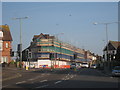


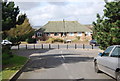
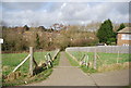

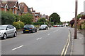
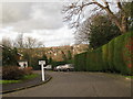
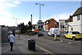
100 photos from this area
Area Information
Key information about the TN38 0TU including its size, population, and administrative classification.
- Area Type
- Postcode
- Area Size
- 1.4 hectares
- Population
- 1732
- Population Density
- 3105 people/km²
House Prices in TN38 0TU
44
Properties
£377,077
Average Sold Price
£88,000
Lowest Price
£825,000
Highest Price
Showing 44 properties
| Address | Type | Beds | Baths | Last Sale Price | Last Sale Date | |
|---|---|---|---|---|---|---|
| 68 Springfield Road, St Leonards On Sea, TN38 0TU | Semi-detached | 4 | 1 | £275,000 | Nov 2025 | |
| 18 Springfield Road, St Leonards On Sea, TN38 0TU | house | 6 | 2 | £465,000 | Mar 2024 | |
| 63 Springfield Road, St Leonards On Sea, TN38 0TU | Detached | 4 | 2 | £825,000 | May 2023 | |
| 19 Springfield Road, St Leonards On Sea, TN38 0TU | Semi-detached | 6 | 1 | £445,000 | Jan 2023 | |
| 17 Springfield Road, St Leonards On Sea, TN38 0TU | Detached | 5 | 2 | £385,000 | Jul 2022 | |
| 61 Springfield Road, St Leonards On Sea, TN38 0TU | house | - | - | £786,000 | Jul 2022 | |
| Basement Flat, 6A Springfield Road, St Leonards On Sea, TN38 0TU | Maisonette | - | - | £440,000 | Nov 2021 | |
| 15 Springfield Road, St Leonards On Sea, TN38 0TU | house | - | - | £570,000 | Jun 2021 | |
| 7 Springfield Road, St Leonards On Sea, TN38 0TU | house | - | - | £575,000 | Jun 2021 | |
| 9 Springfield Road, St Leonards On Sea, TN38 0TU | Semi-detached | 6 | 1 | £490,000 | Mar 2021 |
Page 1 of 5
Energy Efficiency in TN38 0TU
Amenities
Schools
| Rank | School | Type | Entry gender | Ages |
|---|
Explore more schools in this area
Go to Schools tabDemographics
Household Size
One person
most common
Accommodation Type
Houses
most common
Tenure
53
majority
Ethnic Group
White
most common
Religion
N/A
most common
Household Composition
N/A
most common
Age
47
median
Adults (30-64 years)
most common
Household Deprivation
N/A
with no deprivation
NS-SEC
30
in Lower managerial occupations
Explore more demographic insights in this area
Go to Demographics tabPlanning
Planning Constraints
- Flood RiskPremium
- Ramsar Wetland SitesPremium
- Area of Outstanding Natural BeautyPremium
- Protected Nature ReservePremium
- Protected WoodlandPremium