Area Overview for TN35 5ET
Photos of TN35 5ET

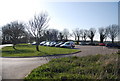
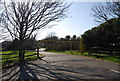
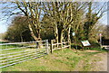
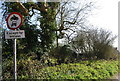


77 photos from this area
Area Information
Key information about the TN35 5ET including its size, population, and administrative classification.
- Area Type
- Postcode
- Area Size
- 2.3 hectares
- Population
- 1847
- Population Density
- 538 people/km²
House Prices in TN35 5ET
42
Properties
£109,653
Average Sold Price
£21,500
Lowest Price
£239,000
Highest Price
Showing 42 properties
| Address | Type | Beds | Baths | Last Sale Price | Last Sale Date | |
|---|---|---|---|---|---|---|
| 23 Firle Close, Hastings, TN35 5ET | Retail | 3 | 1 | £239,000 | Feb 2022 | |
| 52 Firle Close, Hastings, TN35 5ET | Flat | 2 | 1 | £160,000 | Dec 2021 | |
| 44 Firle Close, Hastings, TN35 5ET | Flat | - | - | £90,000 | Nov 2021 | |
| 42 Firle Close, Hastings, TN35 5ET | Flat | - | - | £160,000 | Oct 2021 | |
| 50 Firle Close, Hastings, TN35 5ET | Flat | - | - | £145,000 | Sep 2019 | |
| 25 Firle Close, Hastings, TN35 5ET | Terraced | 3 | 1 | £145,000 | Nov 2015 | |
| 20 Firle Close, Hastings, TN35 5ET | house | - | - | £133,500 | Jun 2015 | |
| 26 Firle Close, Hastings, TN35 5ET | house | - | - | £132,000 | May 2014 | |
| 19 Firle Close, Hastings, TN35 5ET | Terraced | 2 | - | £124,000 | May 2013 | |
| 12 Firle Close, Hastings, TN35 5ET | Detached | 2 | - | £118,000 | Oct 2010 |
Page 1 of 5
Energy Efficiency in TN35 5ET
Amenities
Schools
| Rank | School | Type | Entry gender | Ages |
|---|
Explore more schools in this area
Go to Schools tabDemographics
Household Size
Two person
most common
Accommodation Type
Houses
most common
Tenure
76
majority
Ethnic Group
White
most common
Religion
N/A
most common
Household Composition
N/A
most common
Age
47
median
Adults (30-64 years)
most common
Household Deprivation
N/A
with no deprivation
NS-SEC
30
in Lower managerial occupations
Explore more demographic insights in this area
Go to Demographics tabPlanning
Planning Constraints
- Flood RiskPremium
- Ramsar Wetland SitesPremium
- Area of Outstanding Natural BeautyPremium
- Protected Nature ReservePremium
- Protected WoodlandPremium