Area Overview for TN34 3TF
Photos of TN34 3TF
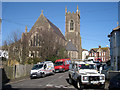
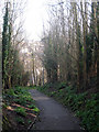
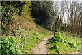
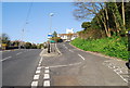
100 photos from this area
Area Information
Key information about the TN34 3TF including its size, population, and administrative classification.
- Area Type
- Postcode
- Area Size
- 7045 m²
- Population
- 1576
- Population Density
- 11412 people/km²
House Prices in TN34 3TF
65
Properties
£178,997
Average Sold Price
£40,500
Lowest Price
£371,000
Highest Price
Showing 65 properties
| Address | Type | Beds | Baths | Last Sale Price | Last Sale Date | |
|---|---|---|---|---|---|---|
| 109 Hughenden Road, Hastings, TN34 3TF | Flat | - | - | £190,000 | May 2023 | |
| 111A Hughenden Road, Hastings, TN34 3TF | Flat | - | - | £180,000 | May 2023 | |
| 69 Hughenden Road, Hastings, TN34 3TF | Terraced | 4 | 1 | £371,000 | Jan 2022 | |
| 61 Hughenden Road, Hastings, TN34 3TF | Terraced | 4 | 1 | £324,000 | Jun 2021 | |
| 103 Hughenden Road, Hastings, TN34 3TF | house | - | - | £190,000 | Feb 2020 | |
| 67 Hughenden Road, Hastings, TN34 3TF | Terraced | 3 | 1 | £250,000 | Sep 2018 | |
| 127 Hughenden Road, Hastings, TN34 3TF | house | - | - | £210,000 | Aug 2018 | |
| 133 Hughenden Road, Hastings, TN34 3TF | house | - | - | £202,500 | Aug 2017 | |
| 57 Hughenden Road, Hastings, TN34 3TF | house | 3 | - | £243,000 | Apr 2017 | |
| 79 Hughenden Road, Hastings, TN34 3TF | house | - | - | £171,000 | Sep 2015 |
Page 1 of 7
Energy Efficiency in TN34 3TF
Amenities
Schools
| Rank | School | Type | Entry gender | Ages |
|---|
Explore more schools in this area
Go to Schools tabDemographics
Household Size
One person
most common
Accommodation Type
Flats
most common
Tenure
51
majority
Ethnic Group
White
most common
Religion
N/A
most common
Household Composition
N/A
most common
Age
47
median
Adults (30-64 years)
most common
Household Deprivation
N/A
with no deprivation
NS-SEC
25
in Lower managerial occupations
Explore more demographic insights in this area
Go to Demographics tabPlanning
Planning Constraints
- Flood RiskPremium
- Ramsar Wetland SitesPremium
- Area of Outstanding Natural BeautyPremium
- Protected Nature ReservePremium
- Protected WoodlandPremium