Area Overview for TN34 2RD
Photos of TN34 2RD
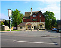
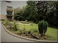
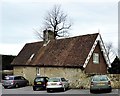
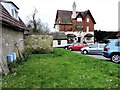
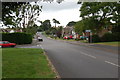
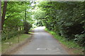
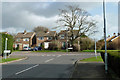
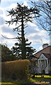
30 photos from this area
Area Information
Key information about the TN34 2RD including its size, population, and administrative classification.
- Area Type
- Postcode
- Area Size
- 2.8 hectares
- Population
- 1574
- Population Density
- 2588 people/km²
House Prices in TN34 2RD
46
Properties
£337,681
Average Sold Price
£189,950
Lowest Price
£550,000
Highest Price
Showing 46 properties
| Address | Type | Beds | Baths | Last Sale Price | Last Sale Date | |
|---|---|---|---|---|---|---|
| 378 The Ridge, Hastings, TN34 2RD | Bungalow | 3 | 1 | £425,000 | May 2022 | |
| 365 The Ridge, Hastings, TN34 2RD | house | - | - | £475,000 | Feb 2022 | |
| 377 The Ridge, Hastings, TN34 2RD | house | - | - | £340,000 | Jun 2021 | |
| 375 The Ridge, Hastings, TN34 2RD | house | - | - | £294,950 | May 2019 | |
| 373 The Ridge, Hastings, TN34 2RD | house | - | - | £299,950 | Apr 2019 | |
| 376 The Ridge, Hastings, TN34 2RD | Bungalow | 3 | 2 | £375,000 | Mar 2018 | |
| East View Housing Management Limited, 370 The Ridge, Hastings, TN34 2RD | Bungalow | - | - | £405,000 | Mar 2016 | |
| 374 The Ridge, Hastings, TN34 2RD | Bungalow | 4 | 5 | £200,000 | Aug 2013 | |
| 368 The Ridge, Hastings, TN34 2RD | Retirement | - | - | £360,000 | Dec 2008 | |
| 363 The Ridge, Hastings, TN34 2RD | house | - | - | £236,000 | May 2005 |
Page 1 of 5
Energy Efficiency in TN34 2RD
Amenities
Schools
| Rank | School | Type | Entry gender | Ages |
|---|
Explore more schools in this area
Go to Schools tabDemographics
Household Size
Two person
most common
Accommodation Type
Houses
most common
Tenure
85
majority
Ethnic Group
White
most common
Religion
N/A
most common
Household Composition
N/A
most common
Age
47
median
Adults (30-64 years)
most common
Household Deprivation
N/A
with no deprivation
NS-SEC
37
in Lower managerial occupations
Explore more demographic insights in this area
Go to Demographics tabPlanning
Planning Constraints
- Flood RiskPremium
- Ramsar Wetland SitesPremium
- Area of Outstanding Natural BeautyPremium
- Protected Nature ReservePremium
- Protected WoodlandPremium