Area Overview for TN34 1RE
Photos of TN34 1RE

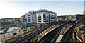
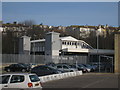
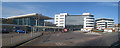
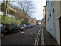
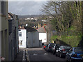
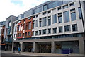
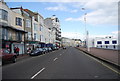
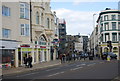
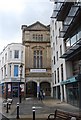
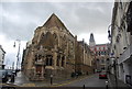
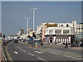
100 photos from this area
Area Information
Key information about the TN34 1RE including its size, population, and administrative classification.
- Area Type
- Postcode
- Area Size
- 4566 m²
- Population
- 1981
- Population Density
- 6614 people/km²
House Prices in TN34 1RE
33
Properties
£163,000
Average Sold Price
£82,000
Lowest Price
£265,000
Highest Price
Showing 33 properties
| Address | Type | Beds | Baths | Last Sale Price | Last Sale Date | |
|---|---|---|---|---|---|---|
| 41A Queens Road, Hastings, TN34 1RE | Maisonette | 2 | 1 | £125,000 | Jun 2018 | |
| 40A Queens Road, Hastings, TN34 1RE | Retail | - | - | £82,000 | Jun 2011 | |
| First Floor Flat, 42 Queens Road, Hastings, TN34 1RE | Retail | 3 | - | £265,000 | Mar 2008 | |
| 70A Queens Road, Hastings, TN34 1RE | Flat | - | - | £180,000 | Dec 2007 | |
| First Floor Rear Flat, 51B Queens Road, Hastings, TN34 1RE | Flat | 1 | 1 | - | - | |
| First Floor Front Flat, 51A Queens Road, Hastings, TN34 1RE | Flat | 1 | 1 | - | - | |
| Flat Above, 49 Queens Road, Hastings, TN34 1RE | Maisonette | 8 | 1 | - | - | |
| Flat, 47 Queens Road, Hastings, TN34 1RE | Maisonette | 2 | 1 | - | - | |
| First Floor And Second Floor Flat, 39 Queens Road, Hastings, TN34 1RE | Maisonette | - | - | - | - | |
| First Floor And Second Floor Flat, 58 Queens Road, Hastings, TN34 1RE | Maisonette | 2 | 1 | - | - |
Page 1 of 4
Energy Efficiency in TN34 1RE
Amenities
Schools
| Rank | School | Type | Entry gender | Ages |
|---|
Explore more schools in this area
Go to Schools tabDemographics
Household Size
One person
most common
Accommodation Type
Flats
most common
Tenure
37
majority
Ethnic Group
White
most common
Religion
N/A
most common
Household Composition
N/A
most common
Age
47
median
Adults (30-64 years)
most common
Household Deprivation
N/A
with no deprivation
NS-SEC
29
in Lower managerial occupations
Explore more demographic insights in this area
Go to Demographics tabPlanning
Planning Constraints
- Flood RiskPremium
- Ramsar Wetland SitesPremium
- Area of Outstanding Natural BeautyPremium
- Protected Nature ReservePremium
- Protected WoodlandPremium