Area Overview for TN34 1RD
Photos of TN34 1RD
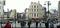
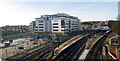


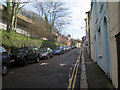
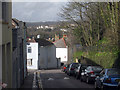
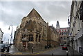
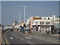
100 photos from this area
Area Information
Key information about the TN34 1RD including its size, population, and administrative classification.
- Area Type
- Postcode
- Area Size
- 2.2 hectares
- Population
- 1922
- Population Density
- 5366 people/km²
House Prices in TN34 1RD
41
Properties
£218,580
Average Sold Price
£71,745
Lowest Price
£432,500
Highest Price
Showing 41 properties
| Address | Type | Beds | Baths | Last Sale Price | Last Sale Date | |
|---|---|---|---|---|---|---|
| 22 Redmayne Drive, Hastings, TN34 1RD | Detached | 4 | 2 | £432,500 | Aug 2025 | |
| 38 Redmayne Drive, Hastings, TN34 1RD | house | 4 | 1 | £346,610 | Nov 2024 | |
| 17 Redmayne Drive, Hastings, TN34 1RD | house | 3 | 1 | £265,000 | Oct 2023 | |
| 3 Redmayne Drive, Hastings, TN34 1RD | Detached | 4 | 3 | £318,000 | Aug 2022 | |
| 4 Redmayne Drive, Hastings, TN34 1RD | house | 4 | 3 | £292,000 | Nov 2020 | |
| 24 Redmayne Drive, Hastings, TN34 1RD | house | 4 | 2 | £375,000 | Nov 2020 | |
| 1 Redmayne Drive, Hastings, TN34 1RD | Terraced | 4 | 3 | £315,000 | Oct 2020 | |
| 27 Redmayne Drive, Hastings, TN34 1RD | Terraced | 4 | 1 | £282,000 | Oct 2020 | |
| 28 Redmayne Drive, Hastings, TN34 1RD | Terraced | 3 | 2 | £255,000 | Feb 2019 | |
| 31 Redmayne Drive, Hastings, TN34 1RD | Semi-detached | 3 | 2 | £256,000 | Jan 2019 |
Page 1 of 5
Energy Efficiency in TN34 1RD
Amenities
Schools
| Rank | School | Type | Entry gender | Ages |
|---|
Explore more schools in this area
Go to Schools tabDemographics
Household Size
One person
most common
Accommodation Type
Flats
most common
Tenure
26
majority
Ethnic Group
White
most common
Religion
N/A
most common
Household Composition
N/A
most common
Age
47
median
Adults (30-64 years)
most common
Household Deprivation
N/A
with no deprivation
NS-SEC
25
in Lower managerial occupations
Explore more demographic insights in this area
Go to Demographics tabPlanning
Planning Constraints
- Flood RiskPremium
- Ramsar Wetland SitesPremium
- Area of Outstanding Natural BeautyPremium
- Protected Nature ReservePremium
- Protected WoodlandPremium