Area Overview for TN33 9JA
Photos of TN33 9JA
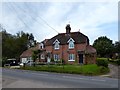
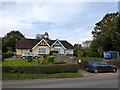
28 photos from this area
Area Information
Key information about the TN33 9JA including its size, population, and administrative classification.
- Area Type
- Postcode
- Area Size
- 37.9 hectares
- Population
- 1200
- Population Density
- 197 people/km²
House Prices in TN33 9JA
8
Properties
£349,000
Average Sold Price
£87,000
Lowest Price
£540,000
Highest Price
Showing 8 properties
| Address | Type | Beds | Baths | Last Sale Price | Last Sale Date | |
|---|---|---|---|---|---|---|
| Shearfold, Catsfield Road, Ninfield, TN33 9JA | Detached | 4 | 2 | £540,000 | Jun 2019 | |
| Baya Cottage, Catsfield Road, Ninfield, TN33 9JA | house | - | - | £420,000 | Oct 2011 | |
| Glendale Cottage, Catsfield Road, Ninfield, TN33 9JA | Detached | - | - | £87,000 | Jul 1995 | |
| Woodland View, Catsfield Road, Ninfield, TN33 9JA | Land | - | - | - | - | |
| Annexe At Bushy Royde, Catsfield Road, Ninfield, TN33 9JA | Cottage | 3 | 1 | - | - | |
| Bushey Royde, Catsfield Road, Ninfield, TN33 9JA | house | 3 | 1 | - | - | |
| Gj Floors, Unit 2, Highway Park, Catsfield Road, Ninfield, TN33 9JA | warehouse | - | - | - | - | |
| Three Oaks Farm, Catsfield Road, Ninfield, TN33 9JA | Farm | - | - | - | - |
Energy Efficiency in TN33 9JA
Amenities
Schools
| Rank | School | Type | Entry gender | Ages |
|---|
Explore more schools in this area
Go to Schools tabDemographics
Household Size
Two person
most common
Accommodation Type
Houses
most common
Tenure
79
majority
Ethnic Group
White
most common
Religion
N/A
most common
Household Composition
N/A
most common
Age
47
median
Adults (30-64 years)
most common
Household Deprivation
N/A
with no deprivation
NS-SEC
35
in Lower managerial occupations
Explore more demographic insights in this area
Go to Demographics tabPlanning
Planning Constraints
- Flood RiskPremium
- Ramsar Wetland SitesPremium
- Area of Outstanding Natural BeautyPremium
- Protected Nature ReservePremium
- Protected WoodlandPremium