Area Overview for TN33 9DB
Photos of TN33 9DB
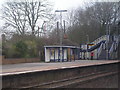

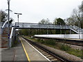
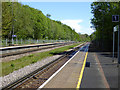

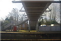
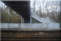
24 photos from this area
Area Information
Key information about the TN33 9DB including its size, population, and administrative classification.
- Area Type
- Postcode
- Area Size
- 26.4 hectares
- Population
- 1421
- Population Density
- 89 people/km²
House Prices in TN33 9DB
39
Properties
£404,882
Average Sold Price
£59,950
Lowest Price
£860,000
Highest Price
Showing 39 properties
| Address | Type | Beds | Baths | Last Sale Price | Last Sale Date | |
|---|---|---|---|---|---|---|
| The Sidings, Station Road, Crowhurst, TN33 9DB | Detached | 4 | 2 | £504,000 | Oct 2025 | |
| Ghyll Shaw, Station Road, Crowhurst, TN33 9DB | house | 4 | 2 | £621,950 | Apr 2023 | |
| Blue Hills, Station Road, Crowhurst, TN33 9DB | house | - | - | £860,000 | Sep 2022 | |
| Chippings, Station Road, Crowhurst, TN33 9DB | house | - | - | £398,000 | Jun 2021 | |
| Sunningdale, Station Road, Crowhurst, TN33 9DB | house | - | - | £520,000 | Jan 2021 | |
| Bradgate, Station Road, Crowhurst, TN33 9DB | Detached | - | - | £520,000 | Aug 2020 | |
| Treetops, Station Road, Crowhurst, TN33 9DB | Detached | 4 | 2 | £430,000 | Jul 2020 | |
| Chiesa Vista, Station Road, Crowhurst, TN33 9DB | Bungalow | - | - | £245,000 | Mar 2020 | |
| Belmont Healthcare, Edendale Lodge, Station Road, Crowhurst, TN33 9DB | Retirement | - | - | £700,000 | Mar 2018 | |
| Longview, Station Road, Crowhurst, TN33 9DB | Detached | - | - | £627,500 | Sep 2017 |
Page 1 of 4
Energy Efficiency in TN33 9DB
Amenities
Schools
| Rank | School | Type | Entry gender | Ages |
|---|
Explore more schools in this area
Go to Schools tabDemographics
Household Size
Two person
most common
Accommodation Type
Houses
most common
Tenure
83
majority
Ethnic Group
White
most common
Religion
N/A
most common
Household Composition
N/A
most common
Age
47
median
Adults (30-64 years)
most common
Household Deprivation
N/A
with no deprivation
NS-SEC
41
in Lower managerial occupations
Explore more demographic insights in this area
Go to Demographics tabPlanning
Planning Constraints
- Flood RiskPremium
- Ramsar Wetland SitesPremium
- Area of Outstanding Natural BeautyPremium
- Protected Nature ReservePremium
- Protected WoodlandPremium