Area Overview for TN33 0TW
Photos of TN33 0TW
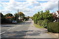

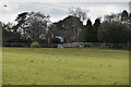

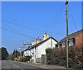
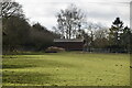


9 photos from this area
Area Information
Key information about the TN33 0TW including its size, population, and administrative classification.
- Area Type
- Postcode
- Area Size
- 14.4 hectares
- Population
- 1421
- Population Density
- 89 people/km²
House Prices in TN33 0TW
29
Properties
£356,765
Average Sold Price
£114,000
Lowest Price
£700,000
Highest Price
Showing 29 properties
| Address | Type | Beds | Baths | Last Sale Price | Last Sale Date | |
|---|---|---|---|---|---|---|
| Camellias, 170 Hastings Road, Battle, TN33 0TW | Bungalow | 4 | - | £700,000 | Sep 2021 | |
| Robins Nest, 152 Hastings Road, Battle, TN33 0TW | Bungalow | 3 | 2 | £440,000 | May 2020 | |
| Annandale, 142 Hastings Road, Battle, TN33 0TW | Detached | 2 | 1 | £216,000 | Mar 2019 | |
| Fairmead, 136 Hastings Road, Battle, TN33 0TW | Bungalow | 4 | 2 | £425,000 | Aug 2018 | |
| The Outlook, 178 Hastings Road, Battle, TN33 0TW | Detached | 2 | - | £355,000 | Nov 2016 | |
| Greenhayes, 106 Hastings Road, Battle, TN33 0TW | house | 4 | - | £377,000 | Feb 2016 | |
| Palings, 130 Hastings Road, Battle, TN33 0TW | Detached | 4 | - | £420,000 | Aug 2015 | |
| The Gables, 148 Hastings Road, Battle, TN33 0TW | Detached | 4 | - | £410,000 | Mar 2015 | |
| Dragon Weyr, 144 Hastings Road, Battle, TN33 0TW | Detached | 2 | - | £220,000 | Sep 2014 | |
| Spinney Cottage, 154 Hastings Road, Battle, TN33 0TW | Bungalow | 2 | 1 | £385,000 | Jul 2014 |
Page 1 of 3
Energy Efficiency in TN33 0TW
Amenities
Schools
| Rank | School | Type | Entry gender | Ages |
|---|
Explore more schools in this area
Go to Schools tabDemographics
Household Size
Two person
most common
Accommodation Type
Houses
most common
Tenure
83
majority
Ethnic Group
White
most common
Religion
N/A
most common
Household Composition
N/A
most common
Age
47
median
Adults (30-64 years)
most common
Household Deprivation
N/A
with no deprivation
NS-SEC
41
in Lower managerial occupations
Explore more demographic insights in this area
Go to Demographics tabPlanning
Planning Constraints
- Flood RiskPremium
- Ramsar Wetland SitesPremium
- Area of Outstanding Natural BeautyPremium
- Protected Nature ReservePremium
- Protected WoodlandPremium