Area Overview for TN33 0QS
Photos of TN33 0QS
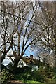
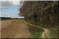
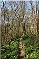
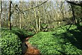
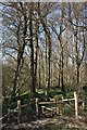
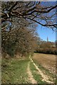
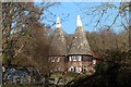
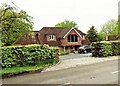
49 photos from this area
Area Information
Key information about the TN33 0QS including its size, population, and administrative classification.
- Area Type
- Postcode
- Area Size
- 47.5 hectares
- Population
- 1499
- Population Density
- 55 people/km²
House Prices in TN33 0QS
15
Properties
£540,121
Average Sold Price
£165,000
Lowest Price
£900,000
Highest Price
Showing 15 properties
| Address | Type | Beds | Baths | Last Sale Price | Last Sale Date | |
|---|---|---|---|---|---|---|
| Constant Spring, Hawkhurst Road, Sedlescombe, TN33 0QS | house | - | - | £900,000 | Jan 2023 | |
| The Anchorage, Hawkhurst Road, Sedlescombe, TN33 0QS | Detached | - | - | £575,000 | Sep 2021 | |
| Calhame, Hawkhurst Road, Sedlescombe, TN33 0QS | Bungalow | - | - | £395,000 | Oct 2018 | |
| Hazlemere, Hawkhurst Road, Sedlescombe, TN33 0QS | house | - | - | £700,000 | Oct 2018 | |
| Amberstone, Hawkhurst Road, Sedlescombe, TN33 0QS | Bungalow | 5 | - | £670,000 | Jan 2016 | |
| Beech Farm House, Hawkhurst Road, Sedlescombe, TN33 0QS | Detached | 5 | - | £900,000 | Oct 2014 | |
| Beech Farm Cottage, Hawkhurst Road, Sedlescombe, TN33 0QS | Bungalow | - | - | £337,450 | Aug 2013 | |
| Old Barn, Hawkhurst Road, Sedlescombe, TN33 0QS | house | - | - | £650,000 | Nov 2009 | |
| Beech Wood, Hawkhurst Road, Sedlescombe, TN33 0QS | Detached | - | - | £675,000 | May 2005 | |
| Beech Farm Bungalow, Hawkhurst Road, Sedlescombe, TN33 0QS | Detached | - | - | £349,000 | Jun 2003 |
Page 1 of 2
Energy Efficiency in TN33 0QS
Amenities
Schools
| Rank | School | Type | Entry gender | Ages |
|---|
Explore more schools in this area
Go to Schools tabDemographics
Household Size
Two person
most common
Accommodation Type
Houses
most common
Tenure
79
majority
Ethnic Group
White
most common
Religion
N/A
most common
Household Composition
N/A
most common
Age
47
median
Adults (30-64 years)
most common
Household Deprivation
N/A
with no deprivation
NS-SEC
39
in Lower managerial occupations
Explore more demographic insights in this area
Go to Demographics tabPlanning
Planning Constraints
- Flood RiskPremium
- Ramsar Wetland SitesPremium
- Area of Outstanding Natural BeautyPremium
- Protected Nature ReservePremium
- Protected WoodlandPremium