Area Overview for TN33 0FY
Photos of TN33 0FY
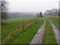
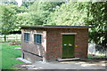
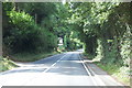
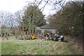

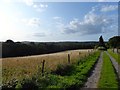
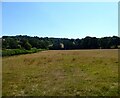
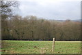
13 photos from this area
Area Information
Key information about the TN33 0FY including its size, population, and administrative classification.
- Area Type
- Postcode
- Area Size
- 2.4 hectares
- Population
- 1813
- Population Density
- 435 people/km²
House Prices in TN33 0FY
32
Properties
£543,933
Average Sold Price
£345,000
Lowest Price
£835,000
Highest Price
Showing 32 properties
| Address | Type | Beds | Baths | Last Sale Price | Last Sale Date | |
|---|---|---|---|---|---|---|
| 20 Lillybank Crescent, Battle, TN33 0FY | house | - | - | £575,000 | Oct 2023 | |
| 40 Lillybank Crescent, Battle, TN33 0FY | house | - | - | £835,000 | Aug 2023 | |
| 30 Lillybank Crescent, Battle, TN33 0FY | house | - | - | £829,000 | Aug 2023 | |
| 4 Lillybank Crescent, Battle, TN33 0FY | house | - | - | £500,000 | Jul 2023 | |
| 22 Lillybank Crescent, Battle, TN33 0FY | house | - | - | £545,000 | Jul 2023 | |
| 28 Lillybank Crescent, Battle, TN33 0FY | house | - | - | £545,000 | Jun 2023 | |
| 36 Lillybank Crescent, Battle, TN33 0FY | house | - | - | £785,000 | Mar 2023 | |
| 6 Lillybank Crescent, Battle, TN33 0FY | Detached | 4 | 2 | £675,000 | Nov 2022 | |
| 23 Lillybank Crescent, Battle, TN33 0FY | house | - | - | £445,000 | May 2022 | |
| 21 Lillybank Crescent, Battle, TN33 0FY | house | - | - | £460,000 | May 2022 |
Page 1 of 4
Energy Efficiency in TN33 0FY
Amenities
Schools
| Rank | School | Type | Entry gender | Ages |
|---|
Explore more schools in this area
Go to Schools tabDemographics
Household Size
Two person
most common
Accommodation Type
Houses
most common
Tenure
79
majority
Ethnic Group
White
most common
Religion
N/A
most common
Household Composition
N/A
most common
Age
47
median
Adults (30-64 years)
most common
Household Deprivation
N/A
with no deprivation
NS-SEC
39
in Lower managerial occupations
Explore more demographic insights in this area
Go to Demographics tabPlanning
Planning Constraints
- Flood RiskPremium
- Ramsar Wetland SitesPremium
- Area of Outstanding Natural BeautyPremium
- Protected Nature ReservePremium
- Protected WoodlandPremium