Area Overview for TN29 0SL
Photos of TN29 0SL
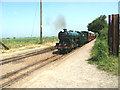
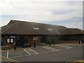
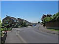
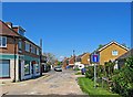
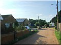
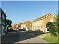
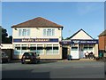
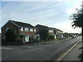
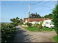
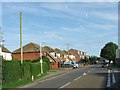
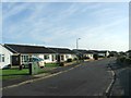
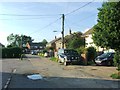
91 photos from this area
Area Information
Key information about the TN29 0SL including its size, population, and administrative classification.
- Area Type
- Postcode
- Area Size
- 1.4 hectares
- Population
- 1243
- Population Density
- 91628 people/km²
House Prices in TN29 0SL
22
Properties
-
Average Sold Price
-
Lowest Price
-
Highest Price
Showing 22 properties
| Address | Type | Beds | Baths | Last Sale Price | Last Sale Date | |
|---|---|---|---|---|---|---|
| 44 Laurel Avenue, St Marys Bay, TN29 0SL | Bungalow | 2 | 1 | - | - | |
| 36 Laurel Avenue, St Marys Bay, TN29 0SL | Semi-detached | 2 | 1 | - | - | |
| 54 Laurel Avenue, St Marys Bay, TN29 0SL | Bungalow | 3 | 2 | - | - | |
| 48 Laurel Avenue, St Marys Bay, TN29 0SL | Semi-detached | 3 | 2 | - | - | |
| 40 Laurel Avenue, St Marys Bay, TN29 0SL | Bungalow | 2 | 2 | - | - | |
| 37 Laurel Avenue, St Marys Bay, TN29 0SL | Bungalow | 3 | 1 | - | - | |
| 42 Laurel Avenue, St Marys Bay, TN29 0SL | Semi-detached | 2 | 1 | - | - | |
| 46 Laurel Avenue, St Marys Bay, TN29 0SL | Bungalow | 2 | - | - | - | |
| 56 Laurel Avenue, St Marys Bay, TN29 0SL | Bungalow | - | - | - | - | |
| 49 Laurel Avenue, St Marys Bay, TN29 0SL | Semi-detached | - | - | - | - |
Page 1 of 3
Energy Efficiency in TN29 0SL
Amenities
Schools
| Rank | School | Type | Entry gender | Ages |
|---|
Explore more schools in this area
Go to Schools tabDemographics
Household Size
Two person
most common
Accommodation Type
Houses
most common
Tenure
82
majority
Ethnic Group
White
most common
Religion
N/A
most common
Household Composition
N/A
most common
Age
47
median
Elderly (65+ years)
most common
Household Deprivation
N/A
with no deprivation
NS-SEC
23
in Lower managerial occupations
Explore more demographic insights in this area
Go to Demographics tabPlanning
Planning Constraints
- Flood RiskPremium
- Ramsar Wetland SitesPremium
- Area of Outstanding Natural BeautyPremium
- Protected Nature ReservePremium
- Protected WoodlandPremium
- Crime & SafetyPremium