Area Overview for TN27 8BS
Photos of TN27 8BS
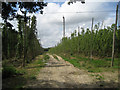
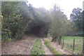
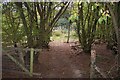

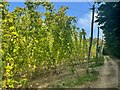
33 photos from this area
Area Information
Key information about the TN27 8BS including its size, population, and administrative classification.
- Area Type
- Postcode
- Area Size
- 10.1 hectares
- Population
- 1313
- Population Density
- 48 people/km²
House Prices in TN27 8BS
11
Properties
£327,508
Average Sold Price
£195,000
Lowest Price
£516,525
Highest Price
Showing 11 properties
| Address | Type | Beds | Baths | Last Sale Price | Last Sale Date | |
|---|---|---|---|---|---|---|
| Sunnyside, Tenterden Road, Biddenden, TN27 8BS | house | - | - | £195,000 | Jan 2019 | |
| Tree Tops, Tenterden Road, Biddenden, TN27 8BS | house | - | - | £271,000 | Jul 2018 | |
| Oak Tree Cottage, Tenterden Road, Biddenden, TN27 8BS | Bungalow | - | - | £516,525 | Jun 2017 | |
| Golden Fleece Farm, Tenterden Road, Biddenden, TN27 8BS | Detached | 5 | - | - | - | |
| Bungalow 2, Woodlands Garage, Tenterden Road, Biddenden, TN27 8BS | undefined | - | - | - | - | |
| Bungalow 1, Woodlands Garage, Tenterden Road, Biddenden, TN27 8BS | Bungalow | 5 | 2 | - | - | |
| Mobile Home At, Duesden Farm, Tenterden Road, Biddenden, TN27 8BS | Mobile Home | - | - | - | - | |
| Duesden Farm, Tenterden Road, Biddenden, TN27 8BS | house | - | - | - | - | |
| Greystones, Tenterden Road, Biddenden, TN27 8BS | Semi-detached | - | - | - | - | |
| Pond View, Tenterden Road, Biddenden, TN27 8BS | Semi-detached | - | - | - | - |
Page 1 of 2
Energy Efficiency in TN27 8BS
Amenities
Schools
| Rank | School | Type | Entry gender | Ages |
|---|
Explore more schools in this area
Go to Schools tabDemographics
Household Size
Two person
most common
Accommodation Type
Houses
most common
Tenure
86
majority
Ethnic Group
White
most common
Religion
N/A
most common
Household Composition
N/A
most common
Age
47
median
Adults (30-64 years)
most common
Household Deprivation
N/A
with no deprivation
NS-SEC
40
in Lower managerial occupations
Explore more demographic insights in this area
Go to Demographics tabPlanning
Planning Constraints
- Flood RiskPremium
- Ramsar Wetland SitesPremium
- Area of Outstanding Natural BeautyPremium
- Protected Nature ReservePremium
- Protected WoodlandPremium