Area Overview for TN27 0HG
Photos of TN27 0HG
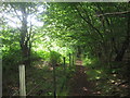
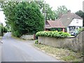
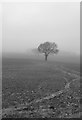
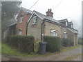
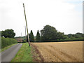
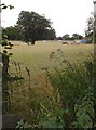
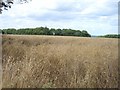
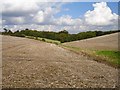
14 photos from this area
Area Information
Key information about the TN27 0HG including its size, population, and administrative classification.
- Area Type
- Postcode
- Area Size
- 34.8 hectares
- Population
- 1165
- Population Density
- 79 people/km²
House Prices in TN27 0HG
9
Properties
£711,500
Average Sold Price
£294,000
Lowest Price
£1,250,000
Highest Price
Showing 9 properties
| Address | Type | Beds | Baths | Last Sale Price | Last Sale Date | |
|---|---|---|---|---|---|---|
| Egg Hill Farm, Stalisfield Road, Charing, TN27 0HG | house | 5 | 3 | £294,000 | Jan 2024 | |
| Kenylon, Kennelling Road, Charing, TN27 0HG | Detached | 4 | 4 | £1,250,000 | Dec 2022 | |
| Hill House, Stalisfield Road, Charing, TN27 0HG | Detached | 5 | 2 | £875,000 | Dec 2020 | |
| Clovelly, Stalisfield Road, Charing, TN27 0HG | house | - | - | £900,000 | Nov 2020 | |
| Bowl Farm, Stalisfield Road, Charing, TN27 0HG | house | - | - | £460,000 | Oct 2014 | |
| Tanglewood, Stalisfield Road, Charing, TN27 0HG | Detached | - | - | £490,000 | Feb 2004 | |
| Caravan, Stalisfield Road, Charing, TN27 0HG | Mobile Home | - | - | - | - | |
| Peter Whitehead Contracting Services, Kenylon Farm, Kennelling Road, Charing, TN27 0HG | Farm | - | - | - | - | |
| Accommodation At, The Bowl Inn, Stalisfield Road, Charing, TN27 0HG | Flat | - | - | - | - |
Energy Efficiency in TN27 0HG
Amenities
Schools
| Rank | School | Type | Entry gender | Ages |
|---|
Explore more schools in this area
Go to Schools tabDemographics
Household Size
Two person
most common
Accommodation Type
Houses
most common
Tenure
83
majority
Ethnic Group
White
most common
Religion
N/A
most common
Household Composition
N/A
most common
Age
47
median
Adults (30-64 years)
most common
Household Deprivation
N/A
with no deprivation
NS-SEC
37
in Lower managerial occupations
Explore more demographic insights in this area
Go to Demographics tabPlanning
Planning Constraints
- Flood RiskPremium
- Ramsar Wetland SitesPremium
- Area of Outstanding Natural BeautyPremium
- Protected Nature ReservePremium
- Protected WoodlandPremium