Area Overview for TN21 8TE
Photos of TN21 8TE
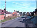
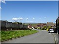
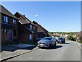
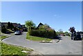
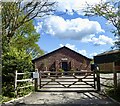
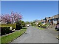
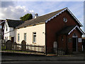
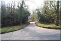
78 photos from this area
Area Information
Key information about the TN21 8TE including its size, population, and administrative classification.
- Area Type
- Postcode
- Area Size
- 9967 m²
- Population
- 1453
- Population Density
- 195 people/km²
House Prices in TN21 8TE
15
Properties
£323,100
Average Sold Price
£113,000
Lowest Price
£490,100
Highest Price
Showing 15 properties
| Address | Type | Beds | Baths | Last Sale Price | Last Sale Date | |
|---|---|---|---|---|---|---|
| Millfield, Burwash Road, Broad Oak, Heathfield, TN21 8TE | house | - | - | £475,000 | Mar 2025 | |
| Woodlea, Burwash Road, Broad Oak, Heathfield, TN21 8TE | Semi-detached | 2 | - | £450,000 | Oct 2022 | |
| Redcroft, Burwash Road, Broad Oak, Heathfield, TN21 8TE | house | - | - | £490,100 | Sep 2021 | |
| Broad Oak House, Burwash Road, Broad Oak, Heathfield, TN21 8TE | house | - | - | £420,000 | Apr 2020 | |
| Lampas, Burwash Road, Broad Oak, Heathfield, TN21 8TE | house | - | - | £350,000 | Jul 2017 | |
| Southdowns, Burwash Road, Broad Oak, Heathfield, TN21 8TE | house | - | - | £305,000 | Nov 2011 | |
| Narrow Ash, Burwash Road, Broad Oak, Heathfield, TN21 8TE | Bungalow | 3 | - | £275,000 | Jun 2010 | |
| Ridgeway House, Burwash Road, Broad Oak, Heathfield, TN21 8TE | Detached | 4 | - | £280,000 | May 2006 | |
| Cranleigh, Burwash Road, Broad Oak, Heathfield, TN21 8TE | Semi-detached | - | - | £239,000 | Jul 2004 | |
| Burwell, Burwash Road, Broad Oak, Heathfield, TN21 8TE | Semi-detached | - | - | £157,000 | Jun 2000 |
Page 1 of 2
Energy Efficiency in TN21 8TE
Amenities
Schools
| Rank | School | Type | Entry gender | Ages |
|---|
Explore more schools in this area
Go to Schools tabDemographics
Household Size
Two person
most common
Accommodation Type
Houses
most common
Tenure
84
majority
Ethnic Group
White
most common
Religion
N/A
most common
Household Composition
N/A
most common
Age
47
median
Adults (30-64 years)
most common
Household Deprivation
N/A
with no deprivation
NS-SEC
36
in Lower managerial occupations
Explore more demographic insights in this area
Go to Demographics tabPlanning
Planning Constraints
- Flood RiskPremium
- Ramsar Wetland SitesPremium
- Area of Outstanding Natural BeautyPremium
- Protected Nature ReservePremium
- Protected WoodlandPremium