Area Overview for TN21 0XL
Photos of TN21 0XL
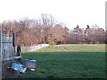
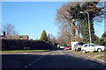
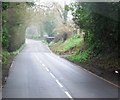
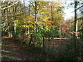
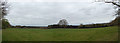
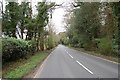
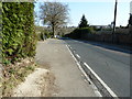
19 photos from this area
Area Information
Key information about the TN21 0XL including its size, population, and administrative classification.
- Area Type
- Postcode
- Area Size
- 8693 m²
- Population
- 1787
- Population Density
- 3363 people/km²
House Prices in TN21 0XL
9
Properties
£461,250
Average Sold Price
£250,000
Lowest Price
£725,000
Highest Price
Showing 9 properties
| Address | Type | Beds | Baths | Last Sale Price | Last Sale Date | |
|---|---|---|---|---|---|---|
| April Cottage, Ghyll Road, Heathfield, TN21 0XL | house | 5 | 3 | £725,000 | Dec 2024 | |
| Applewood, Ghyll Road, Heathfield, TN21 0XL | Detached | 3 | 1 | £420,000 | Apr 2023 | |
| Lynton, Ghyll Road, Heathfield, TN21 0XL | house | - | - | £450,000 | Sep 2021 | |
| Fairways, Ghyll Road, Heathfield, TN21 0XL | house | - | - | £250,000 | Nov 2010 | |
| Moon Cottage, Ghyll Road, Heathfield, TN21 0XL | Detached | 3 | 1 | - | - | |
| Wheel Cottage, Ghyll Road, Heathfield, TN21 0XL | Semi-detached | - | - | - | - | |
| Glenmoor, Ghyll Road, Heathfield, TN21 0XL | Semi-detached | - | - | - | - | |
| Shalimar, Ghyll Road, Heathfield, TN21 0XL | Detached | - | - | - | - | |
| Broadway, Ghyll Road, Heathfield, TN21 0XL | house | - | - | - | - |
Energy Efficiency in TN21 0XL
Amenities
Schools
| Rank | School | Type | Entry gender | Ages |
|---|
Explore more schools in this area
Go to Schools tabDemographics
Household Size
One person
most common
Accommodation Type
Houses
most common
Tenure
62
majority
Ethnic Group
White
most common
Religion
N/A
most common
Household Composition
N/A
most common
Age
47
median
Adults (30-64 years)
most common
Household Deprivation
N/A
with no deprivation
NS-SEC
31
in Lower managerial occupations
Explore more demographic insights in this area
Go to Demographics tabPlanning
Planning Constraints
- Flood RiskPremium
- Ramsar Wetland SitesPremium
- Area of Outstanding Natural BeautyPremium
- Protected Nature ReservePremium
- Protected WoodlandPremium