Area Overview for TN21 0TF
Photos of TN21 0TF
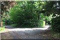
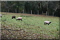
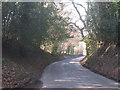
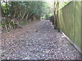
20 photos from this area
Area Information
Key information about the TN21 0TF including its size, population, and administrative classification.
- Area Type
- Postcode
- Area Size
- 5255 m²
- Population
- 2764
- Population Density
- 84 people/km²
House Prices in TN21 0TF
8
Properties
£389,250
Average Sold Price
£295,000
Lowest Price
£650,000
Highest Price
Showing 8 properties
| Address | Type | Beds | Baths | Last Sale Price | Last Sale Date | |
|---|---|---|---|---|---|---|
| Little Warren, Warren Lane, Cross In Hand, Heathfield, TN21 0TF | house | - | - | £650,000 | Mar 2021 | |
| Garwoods, Warren Lane, Cross In Hand, Heathfield, TN21 0TF | Semi-detached | 3 | - | £312,000 | Apr 2011 | |
| Mickleton Cottage, Warren Lane, Cross In Hand, Heathfield, TN21 0TF | Semi-detached | - | - | £300,000 | Jul 2005 | |
| White Mist Cottage, Warren Lane, Cross In Hand, Heathfield, TN21 0TF | Semi-detached | 3 | 1 | £295,000 | May 2004 | |
| The Lilacs, Warren Lane, Cross In Hand, Heathfield, TN21 0TF | Detached | 3 | 2 | - | - | |
| Woodpeckers, Warren Lane, Cross In Hand, Heathfield, TN21 0TF | Semi-detached | - | - | - | - | |
| 1, Burnetts Cottages, Warren Lane, Cross In Hand, Heathfield, TN21 0TF | Semi-detached | - | - | - | - | |
| Old Bakery Cottage, Warren Lane, Cross In Hand, Heathfield, TN21 0TF | Semi-detached | - | - | - | - |
Energy Efficiency in TN21 0TF
Amenities
Schools
| Rank | School | Type | Entry gender | Ages |
|---|
Explore more schools in this area
Go to Schools tabDemographics
Household Size
Two person
most common
Accommodation Type
Houses
most common
Tenure
85
majority
Ethnic Group
White
most common
Religion
N/A
most common
Household Composition
N/A
most common
Age
47
median
Adults (30-64 years)
most common
Household Deprivation
N/A
with no deprivation
NS-SEC
42
in Lower managerial occupations
Explore more demographic insights in this area
Go to Demographics tabPlanning
Planning Constraints
- Flood RiskPremium
- Ramsar Wetland SitesPremium
- Area of Outstanding Natural BeautyPremium
- Protected Nature ReservePremium
- Protected WoodlandPremium