Area Overview for TN21 0QD
Photos of TN21 0QD

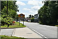
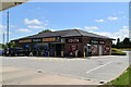
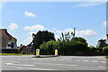
49 photos from this area
Area Information
Key information about the TN21 0QD including its size, population, and administrative classification.
- Area Type
- Postcode
- Area Size
- 14.5 hectares
- Population
- 1445
- Population Density
- 289 people/km²
House Prices in TN21 0QD
18
Properties
£604,808
Average Sold Price
£31,000
Lowest Price
£1,092,500
Highest Price
Showing 18 properties
| Address | Type | Beds | Baths | Last Sale Price | Last Sale Date | |
|---|---|---|---|---|---|---|
| Pippins, Back Lane, Cross In Hand, Heathfield, TN21 0QD | Detached | 5 | 3 | £1,075,000 | Oct 2023 | |
| Spring Field Cottage, Back Lane, Cross In Hand, Heathfield, TN21 0QD | house | 4 | 3 | £900,000 | Mar 2021 | |
| Claytons, Back Lane, Cross In Hand, Heathfield, TN21 0QD | Bungalow | - | - | £640,000 | Feb 2021 | |
| Coppice, Back Lane, Cross In Hand, Heathfield, TN21 0QD | Bungalow | 4 | 2 | £750,000 | Sep 2020 | |
| Cranemoor, Back Lane, Cross In Hand, Heathfield, TN21 0QD | Detached | 5 | 3 | £1,092,500 | Oct 2019 | |
| Fidra, Back Lane, Cross In Hand, Heathfield, TN21 0QD | Detached | 4 | 3 | £745,000 | Dec 2018 | |
| Brook House, Back Lane, Cross In Hand, Heathfield, TN21 0QD | Detached | - | - | £31,000 | Mar 2018 | |
| Pool Meadow, Back Lane, Cross In Hand, Heathfield, TN21 0QD | house | - | - | £775,000 | Nov 2015 | |
| Old Well Cottage, Back Lane, Cross In Hand, Heathfield, TN21 0QD | Semi-detached | 3 | - | £345,000 | Nov 2014 | |
| Hope Cottage, Back Lane, Cross In Hand, Heathfield, TN21 0QD | Semi-detached | - | - | £290,000 | Jul 2009 |
Page 1 of 2
Energy Efficiency in TN21 0QD
Amenities
Schools
| Rank | School | Type | Entry gender | Ages |
|---|
Explore more schools in this area
Go to Schools tabDemographics
Household Size
Two person
most common
Accommodation Type
Houses
most common
Tenure
85
majority
Ethnic Group
White
most common
Religion
N/A
most common
Household Composition
N/A
most common
Age
47
median
Adults (30-64 years)
most common
Household Deprivation
N/A
with no deprivation
NS-SEC
43
in Lower managerial occupations
Explore more demographic insights in this area
Go to Demographics tabPlanning
Planning Constraints
- Flood RiskPremium
- Ramsar Wetland SitesPremium
- Area of Outstanding Natural BeautyPremium
- Protected Nature ReservePremium
- Protected WoodlandPremium