Area Overview for TN21 0BN
Photos of TN21 0BN


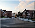

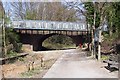
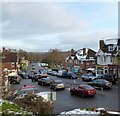


99 photos from this area
Area Information
Key information about the TN21 0BN including its size, population, and administrative classification.
- Area Type
- Postcode
- Area Size
- 8085 m²
- Population
- 1691
- Population Density
- 206 people/km²
House Prices in TN21 0BN
17
Properties
£208,992
Average Sold Price
£73,950
Lowest Price
£400,000
Highest Price
Showing 17 properties
| Address | Type | Beds | Baths | Last Sale Price | Last Sale Date | |
|---|---|---|---|---|---|---|
| Rose Cottage, Little London Road, Horam, TN21 0BN | Semi-detached | 3 | 1 | £400,000 | Nov 2022 | |
| La Motte, Little London Road, Horam, TN21 0BN | Detached | 2 | 1 | £300,000 | Aug 2020 | |
| 1, Reads Flats, Little London Road, Horam, TN21 0BN | Maisonette | - | - | £125,000 | Apr 2018 | |
| 2, Reads Flats, Little London Road, Horam, TN21 0BN | Flat | 2 | 1 | £142,000 | Jul 2017 | |
| Woodhae, Little London Road, Horam, TN21 0BN | Detached | 4 | 1 | £352,000 | Jun 2015 | |
| Hope House, Little London Road, Horam, TN21 0BN | house | 3 | - | £265,000 | Oct 2014 | |
| Pembroke, Little London Road, Horam, TN21 0BN | Bungalow | 4 | - | £237,000 | Oct 2011 | |
| 8 Little London Road, Horam, TN21 0BN | Semi-detached | 3 | 1 | £200,000 | Dec 2007 | |
| Valmorin, Little London Road, Horam, TN21 0BN | Semi-detached | - | - | £189,000 | Oct 2003 | |
| Kiora, Little London Road, Horam, TN21 0BN | Semi-detached | - | - | £73,950 | Aug 1997 |
Page 1 of 2
Energy Efficiency in TN21 0BN
Amenities
Schools
| Rank | School | Type | Entry gender | Ages |
|---|
Explore more schools in this area
Go to Schools tabDemographics
Household Size
Two person
most common
Accommodation Type
Houses
most common
Tenure
89
majority
Ethnic Group
White
most common
Religion
N/A
most common
Household Composition
N/A
most common
Age
47
median
Adults (30-64 years)
most common
Household Deprivation
N/A
with no deprivation
NS-SEC
40
in Lower managerial occupations
Explore more demographic insights in this area
Go to Demographics tabPlanning
Planning Constraints
- Flood RiskPremium
- Ramsar Wetland SitesPremium
- Area of Outstanding Natural BeautyPremium
- Protected Nature ReservePremium
- Protected WoodlandPremium