Area Overview for TN20 6UL
Photos of TN20 6UL
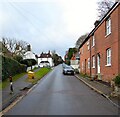
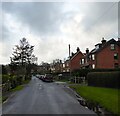
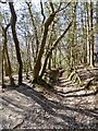
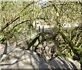
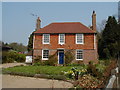
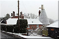

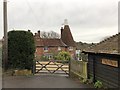
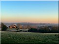
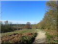
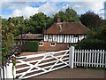
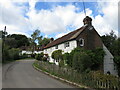
100 photos from this area
Area Information
Key information about the TN20 6UL including its size, population, and administrative classification.
- Area Type
- Postcode
- Area Size
- 26.9 hectares
- Population
- 1574
- Population Density
- 59 people/km²
House Prices in TN20 6UL
23
Properties
£635,737
Average Sold Price
£315,000
Lowest Price
£1,177,000
Highest Price
Showing 23 properties
| Address | Type | Beds | Baths | Last Sale Price | Last Sale Date | |
|---|---|---|---|---|---|---|
| Grange View, Coggins Mill Lane, Mayfield, TN20 6UL | Detached | 4 | 1 | £840,000 | Mar 2024 | |
| Bramble Tye, Coggins Mill Lane, Mayfield, TN20 6UL | Detached | 3 | 2 | £685,000 | Dec 2021 | |
| Spring House, Coggins Mill Lane, Mayfield, TN20 6UL | Detached | 5 | 4 | £795,000 | Jun 2021 | |
| Fairhill, Coggins Mill Lane, Mayfield, TN20 6UL | house | - | - | £1,177,000 | Mar 2020 | |
| Little Combe, Coggins Mill Lane, Mayfield, TN20 6UL | Detached | 5 | 2 | £895,000 | Oct 2018 | |
| Coombers, Coggins Mill Lane, Mayfield, TN20 6UL | Detached | 4 | 2 | £760,000 | Sep 2018 | |
| Overdale, Coggins Mill Lane, Mayfield, TN20 6UL | Bungalow | 4 | 2 | £550,000 | Apr 2018 | |
| Weald Cottage, Coggins Mill Lane, Mayfield, TN20 6UL | house | - | - | £950,000 | Dec 2016 | |
| Whiteways, Coggins Mill Lane, Mayfield, TN20 6UL | house | 4 | - | £765,000 | Nov 2012 | |
| High Brunner, Coggins Mill Lane, Mayfield, TN20 6UL | house | 5 | - | £685,000 | Oct 2012 |
Page 1 of 3
Energy Efficiency in TN20 6UL
Amenities
Schools
| Rank | School | Type | Entry gender | Ages |
|---|
Explore more schools in this area
Go to Schools tabDemographics
Household Size
Two person
most common
Accommodation Type
Houses
most common
Tenure
85
majority
Ethnic Group
White
most common
Religion
N/A
most common
Household Composition
N/A
most common
Age
47
median
Adults (30-64 years)
most common
Household Deprivation
N/A
with no deprivation
NS-SEC
47
in Lower managerial occupations
Explore more demographic insights in this area
Go to Demographics tabPlanning
Planning Constraints
- Flood RiskPremium
- Ramsar Wetland SitesPremium
- Area of Outstanding Natural BeautyPremium
- Protected Nature ReservePremium
- Protected WoodlandPremium