Area Overview for TN20 6TB
Photos of TN20 6TB
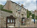
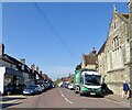
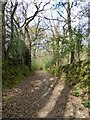
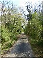

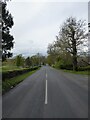
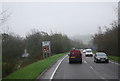

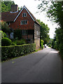
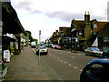
100 photos from this area
Area Information
Key information about the TN20 6TB including its size, population, and administrative classification.
- Area Type
- Postcode
- Area Size
- 2.3 hectares
- Population
- 1226
- Population Density
- 497 people/km²
House Prices in TN20 6TB
11
Properties
£368,750
Average Sold Price
£160,000
Lowest Price
£625,000
Highest Price
Showing 11 properties
| Address | Type | Beds | Baths | Last Sale Price | Last Sale Date | |
|---|---|---|---|---|---|---|
| 3, Carpenters Cottages, Fletching Street, Mayfield, TN20 6TB | Terraced | 2 | 2 | £490,000 | Aug 2023 | |
| Bluebell Cottage, Fletching Street, Mayfield, TN20 6TB | Detached | 3 | 2 | £625,000 | Mar 2023 | |
| Rock Cottage, Fletching Street, Mayfield, TN20 6TB | Semi-detached | 2 | 1 | £200,000 | Mar 2007 | |
| Fletching Cottage, Fletching Street, Mayfield, TN20 6TB | Semi-detached | - | - | £160,000 | Oct 1999 | |
| 2, Carpenters Cottages, Fletching Street, Mayfield, TN20 6TB | Terraced | 3 | 2 | - | - | |
| 1, Carpenters Cottages, Fletching Street, Mayfield, TN20 6TB | Terraced | 2 | - | - | - | |
| Nevassa, Fletching Street, Mayfield, TN20 6TB | Semi-detached | - | - | - | - | |
| Charity Cottage, Fletching Street, Mayfield, TN20 6TB | Detached | - | - | - | - | |
| Maynards, Fletching Street, Mayfield, TN20 6TB | Semi-detached | - | - | - | - | |
| Bin Store At 2 To 10 3 For Recycling Only, St Leonards Lane, Mayfield, TN20 6TB | Industrial | - | - | - | - |
Page 1 of 2
Energy Efficiency in TN20 6TB
Amenities
Schools
| Rank | School | Type | Entry gender | Ages |
|---|
Explore more schools in this area
Go to Schools tabDemographics
Household Size
One person
most common
Accommodation Type
Houses
most common
Tenure
67
majority
Ethnic Group
White
most common
Religion
N/A
most common
Household Composition
N/A
most common
Age
47
median
Adults (30-64 years)
most common
Household Deprivation
N/A
with no deprivation
NS-SEC
44
in Lower managerial occupations
Explore more demographic insights in this area
Go to Demographics tabPlanning
Planning Constraints
- Flood RiskPremium
- Ramsar Wetland SitesPremium
- Area of Outstanding Natural BeautyPremium
- Protected Nature ReservePremium
- Protected WoodlandPremium