Area Overview for TN20 6ET
Photos of TN20 6ET
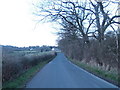
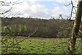
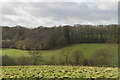

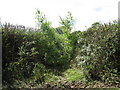

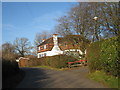
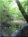
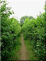
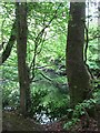
22 photos from this area
Area Information
Key information about the TN20 6ET including its size, population, and administrative classification.
- Area Type
- Postcode
- Area Size
- 41.4 hectares
- Population
- 1574
- Population Density
- 59 people/km²
House Prices in TN20 6ET
22
Properties
£760,550
Average Sold Price
£225,000
Lowest Price
£1,500,000
Highest Price
Showing 22 properties
| Address | Type | Beds | Baths | Last Sale Price | Last Sale Date | |
|---|---|---|---|---|---|---|
| The Larks Nest, Rotherfield Lane, Mayfield, TN20 6ET | Land | - | - | £580,000 | Mar 2023 | |
| Larks Nest, Rotherfield Lane, Mayfield, TN20 6ET | Detached | - | - | £580,000 | Mar 2023 | |
| Rydal House, Rotherfield Lane, Mayfield, TN20 6ET | Detached | 5 | 3 | £1,500,000 | Mar 2022 | |
| Rose Cottage, Rotherfield Lane, Mayfield, TN20 6ET | Retail | 4 | 2 | £1,020,000 | Mar 2022 | |
| Ardsil, Rotherfield Lane, Mayfield, TN20 6ET | Detached | 4 | 3 | £850,000 | Nov 2017 | |
| Corner Cottage, Rotherfield Lane, Mayfield, TN20 6ET | Detached | 3 | - | £568,000 | Oct 2016 | |
| Charnwood, Rotherfield Lane, Mayfield, TN20 6ET | house | 5 | - | £740,000 | Jun 2014 | |
| The Beeches, Rotherfield Lane, Mayfield, TN20 6ET | Detached | 7 | - | £950,000 | Jun 2011 | |
| Oaktrees, Rotherfield Lane, Mayfield, TN20 6ET | Detached | 4 | 4 | £592,500 | Jul 2004 | |
| Westbury, Rotherfield Lane, Mayfield, TN20 6ET | house | - | - | £225,000 | Oct 1997 |
Page 1 of 3
Energy Efficiency in TN20 6ET
Amenities
Schools
| Rank | School | Type | Entry gender | Ages |
|---|
Explore more schools in this area
Go to Schools tabDemographics
Household Size
Two person
most common
Accommodation Type
Houses
most common
Tenure
85
majority
Ethnic Group
White
most common
Religion
N/A
most common
Household Composition
N/A
most common
Age
47
median
Adults (30-64 years)
most common
Household Deprivation
N/A
with no deprivation
NS-SEC
47
in Lower managerial occupations
Explore more demographic insights in this area
Go to Demographics tabPlanning
Planning Constraints
- Flood RiskPremium
- Ramsar Wetland SitesPremium
- Area of Outstanding Natural BeautyPremium
- Protected Nature ReservePremium
- Protected WoodlandPremium